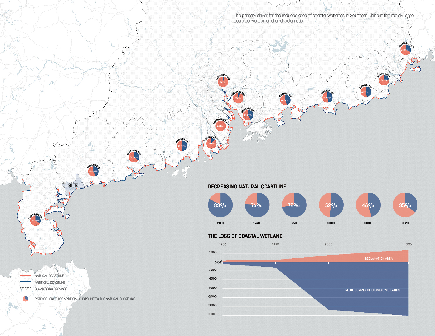
Guangdong Province has the longest coastline in China, but the coastal wetlands have been gradually reduced in the last 40 years. The primary driver for the reduced area is large-scale land reclamation. The tropical intensity that reaches land has become stronger since the mid-1990s in the province. The area around Wuchuan is where tropical cyclones land most frequently.
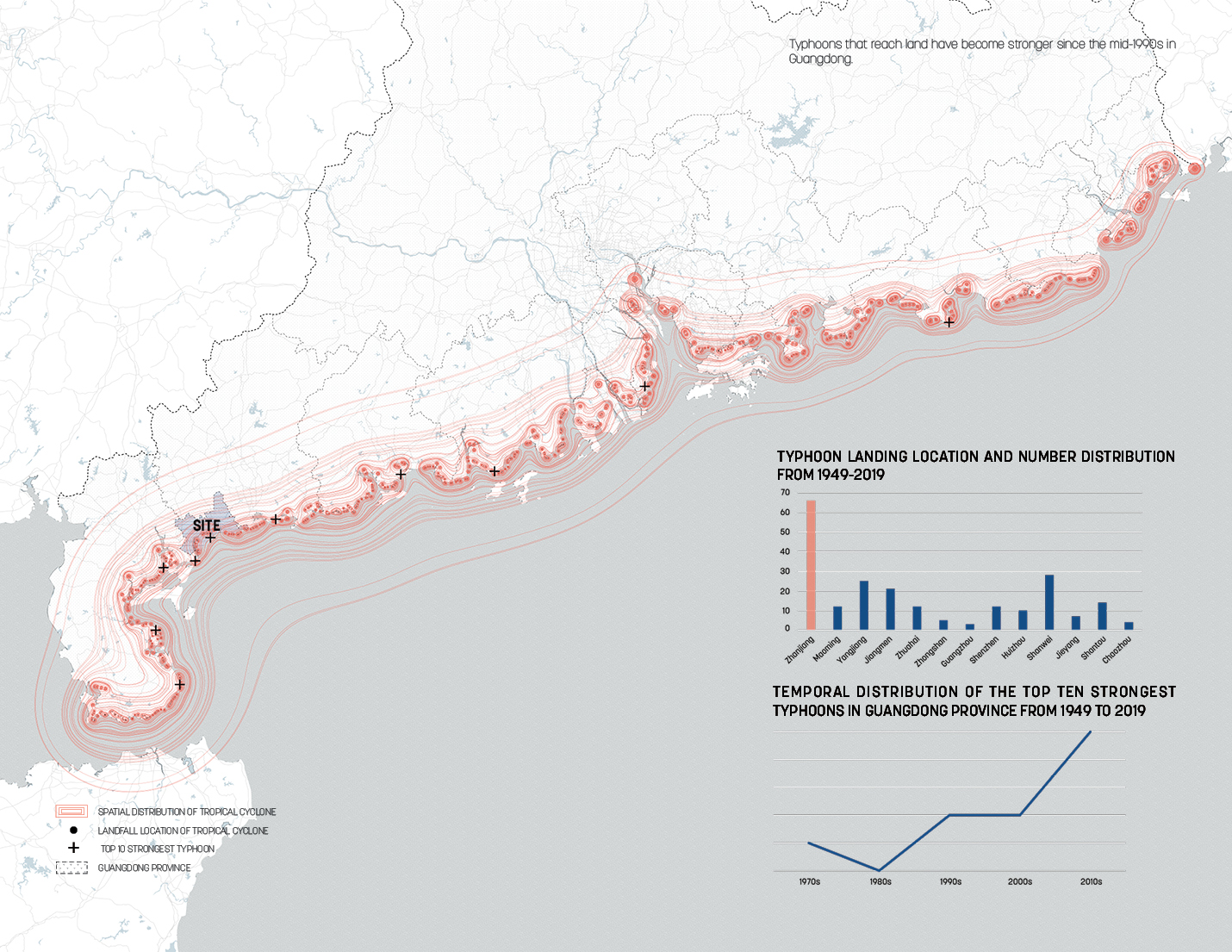
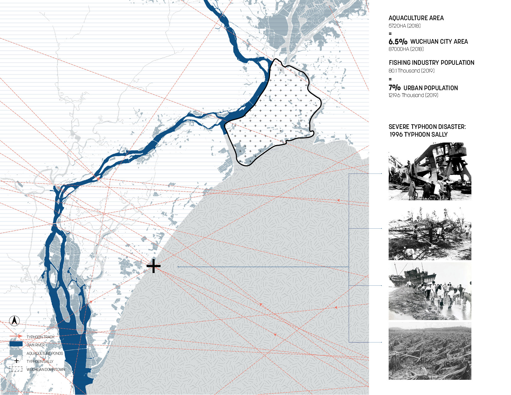
Wuchuan is a disaster-prone city. Typhoon Sally in 1996 strongly destroyed part of the infrastructure in the city and caused casualties. At the same time, Wuchuan is also the main aquaculture base due to crisscrossed water systems.
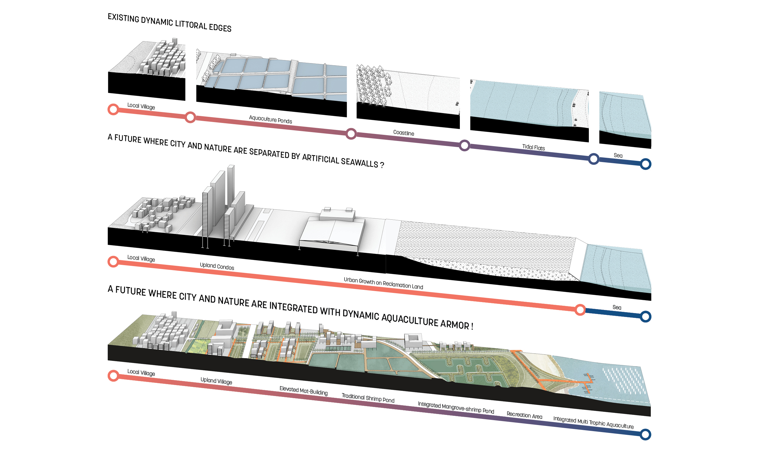
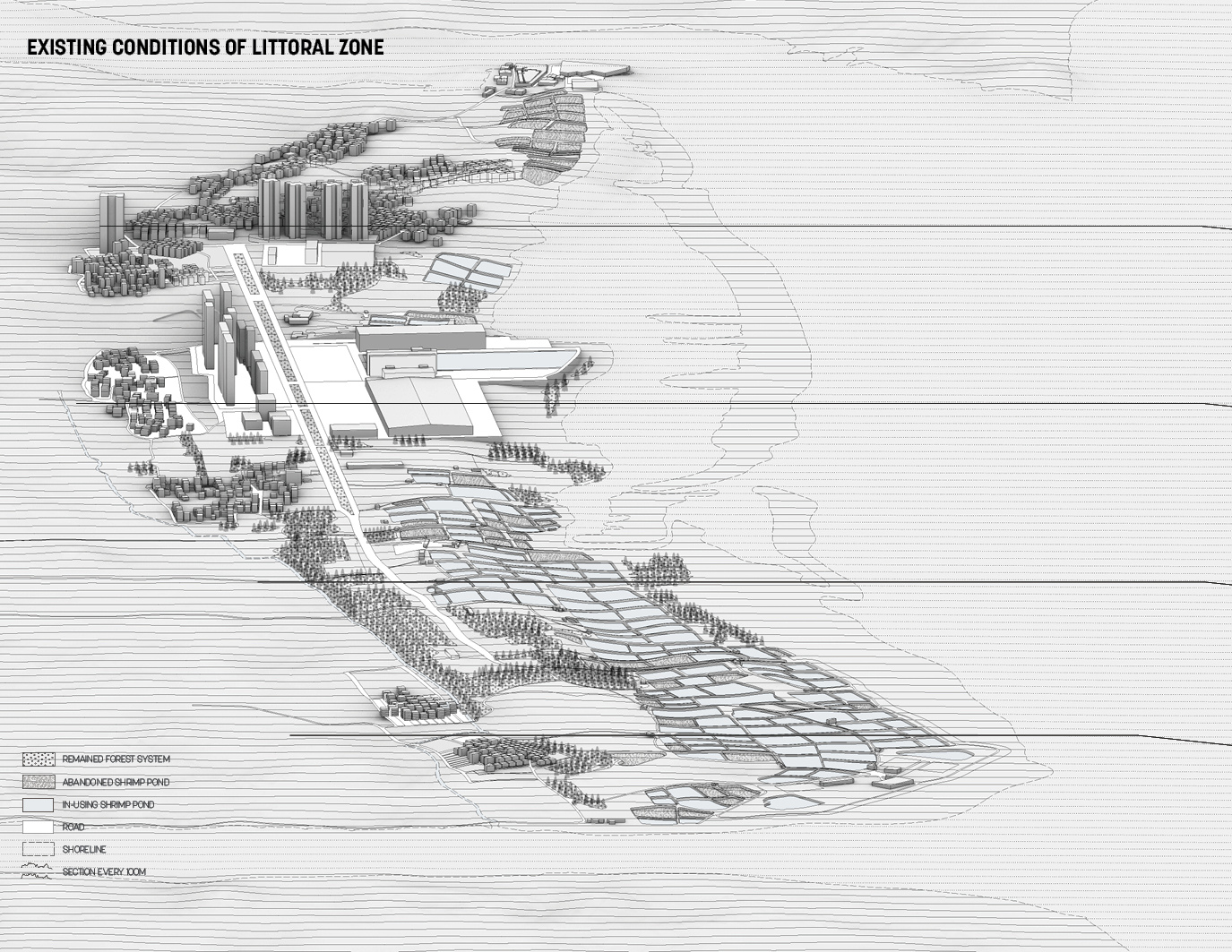
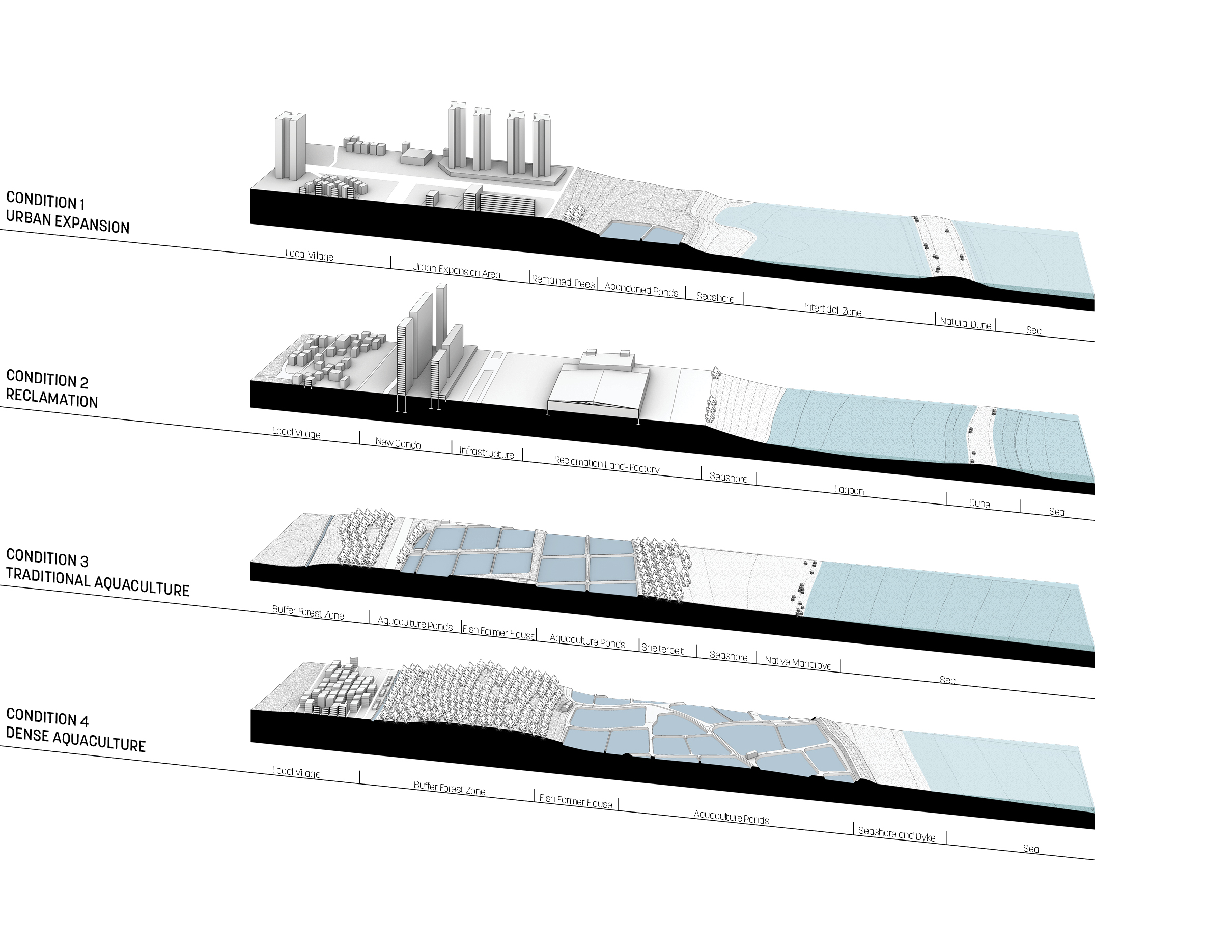
Wuchuan’s existing coastal structure can be categorized into four types of conditions. In dense aquaculture areas, fish farmers reclaim part of the seashore and build a dyke to protect their ponds. The traditional aquaculture system consists of shelterbelts, Aquaculture ponds, and native mangroves. The government reclaims the middle side of the coast for building factories. On the east side of the beach, the coastline consists of new urban expansion and the natural dune offshore.
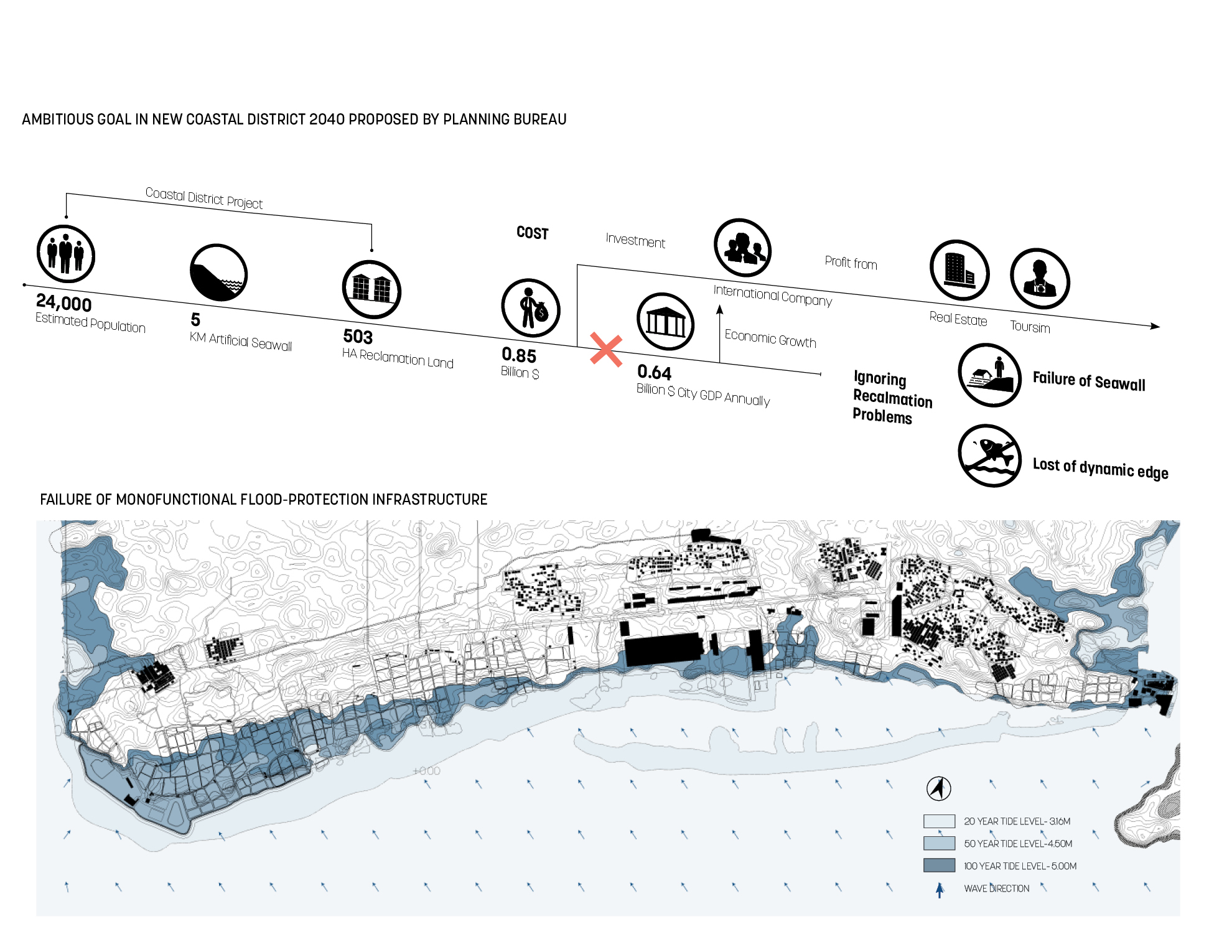
In 2020, the local planning bureau proposed to reclaim 500 hectares land and build a 5KM artificial seawall. However, as a fringe city in Guangdong Province, the annual GDP of the city is lower than the cost of infrastructure construction. The international company will undertake the development process from investment to maintenance. To gain profit as quickly as possible, the reclamation landowner is going to explore real estate and tourist attractions, ignoring typical land reclamation problems in city.
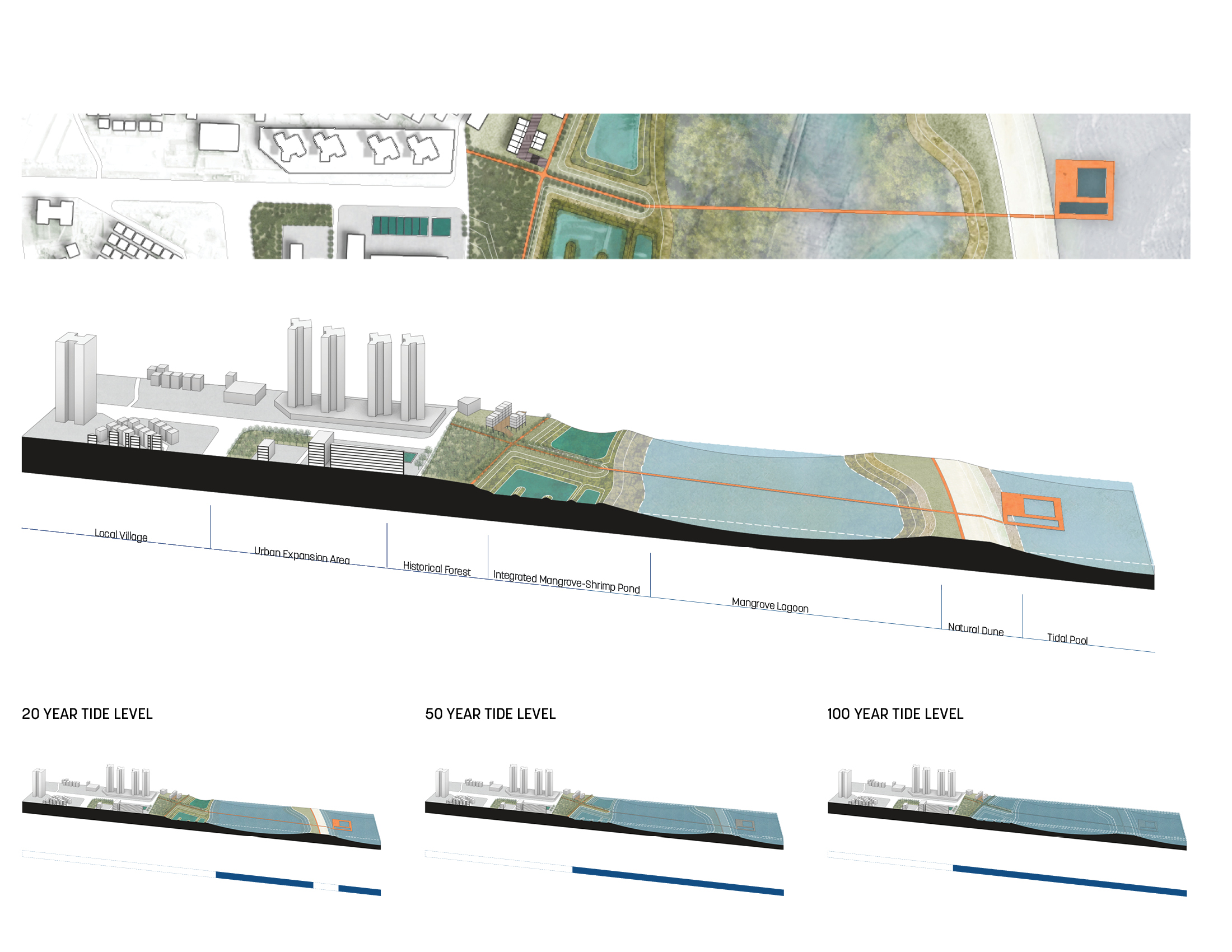
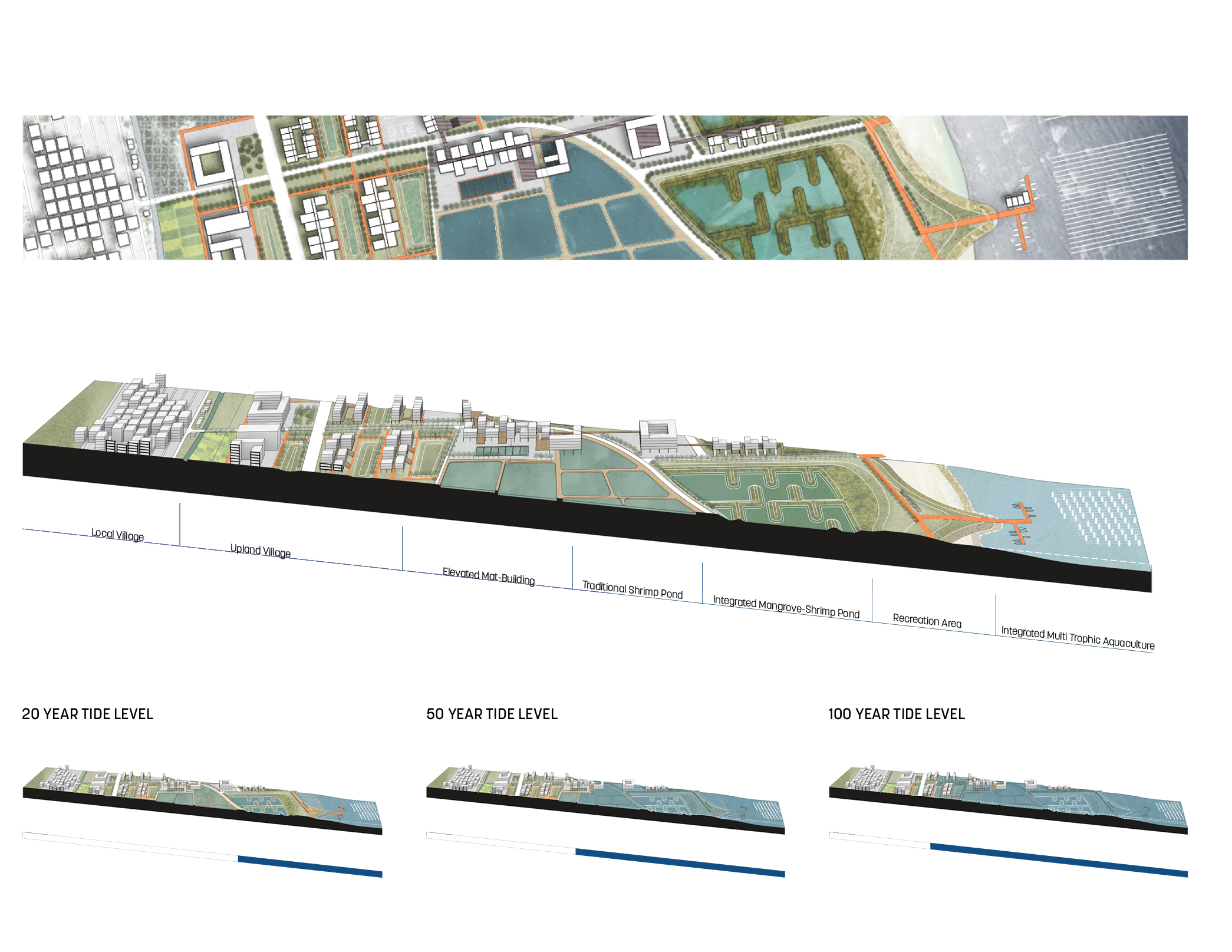
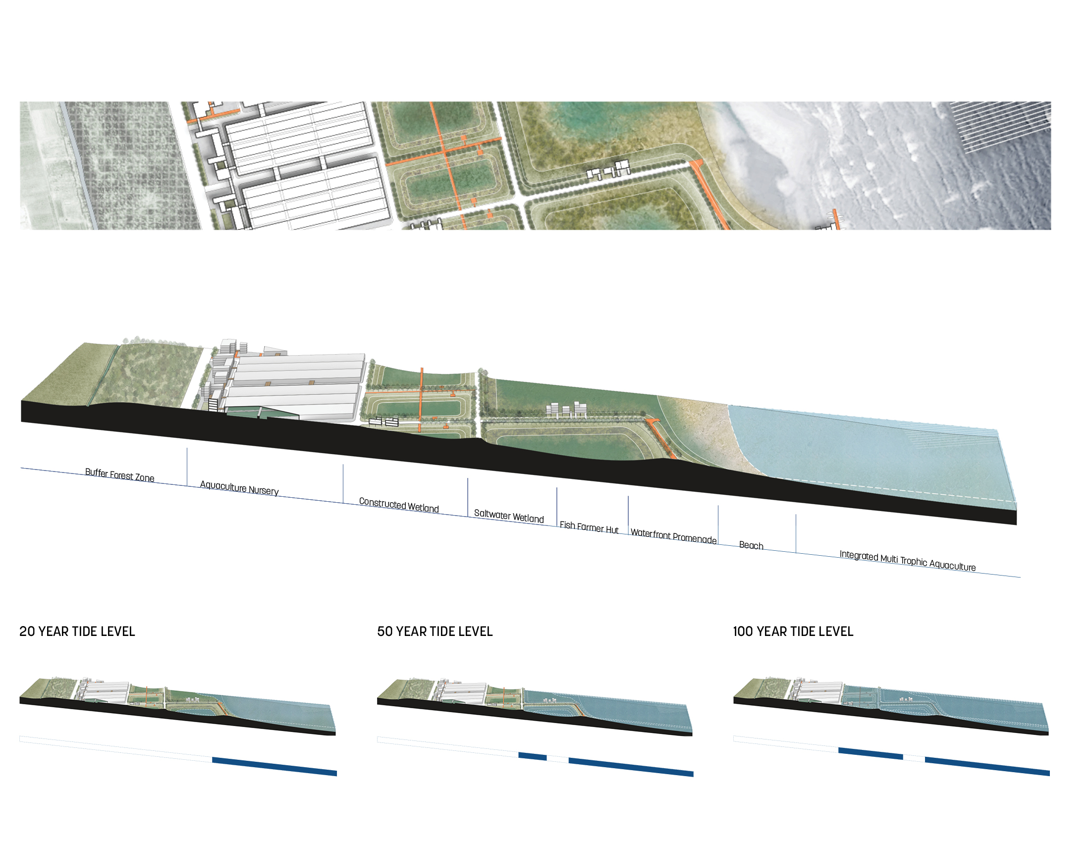
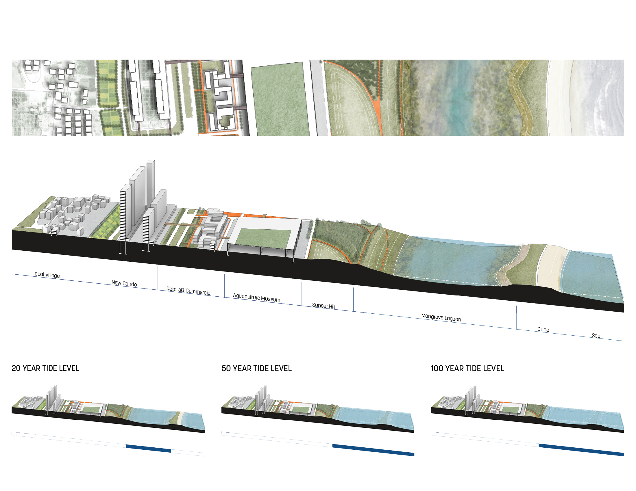
The first problem is monofunctional flood-protection infrastructure, such as seawalls, which is prone to failure. Under 50-year tide and 100-year tide levels, those new urban development areas in the littoral zone will be flooded. The second is that reclamation land blocks the original dynamic edge in the littoral zone. They are harmful to the marine ecologies that had existed before the infrastructure was built. The relationship between the city and nature will change fundamentally.
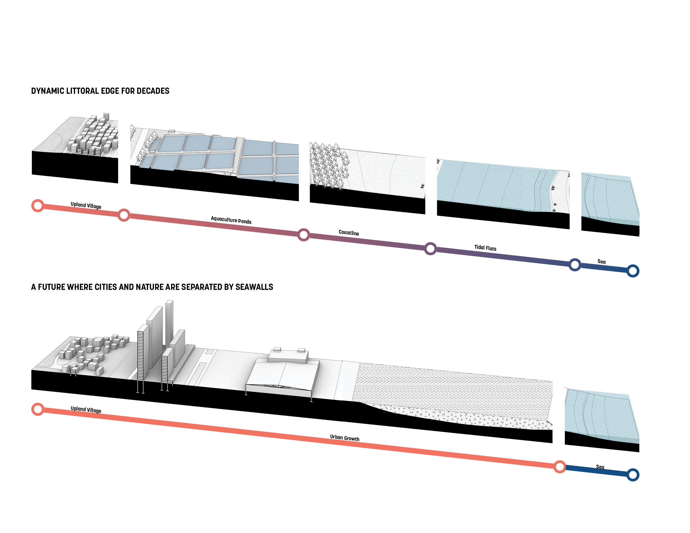
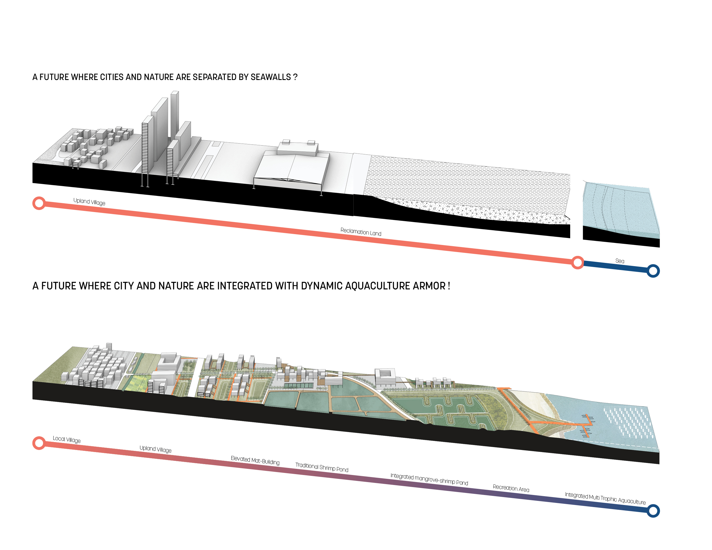
The project proposes an alternative where city and nature are integrated with dynamic aquaculture armor to respond to the typical coastal urban growth problems with land reclamation.
The design is generated by establishing multi-level aquaculture armor and the interconnection with the current environment.
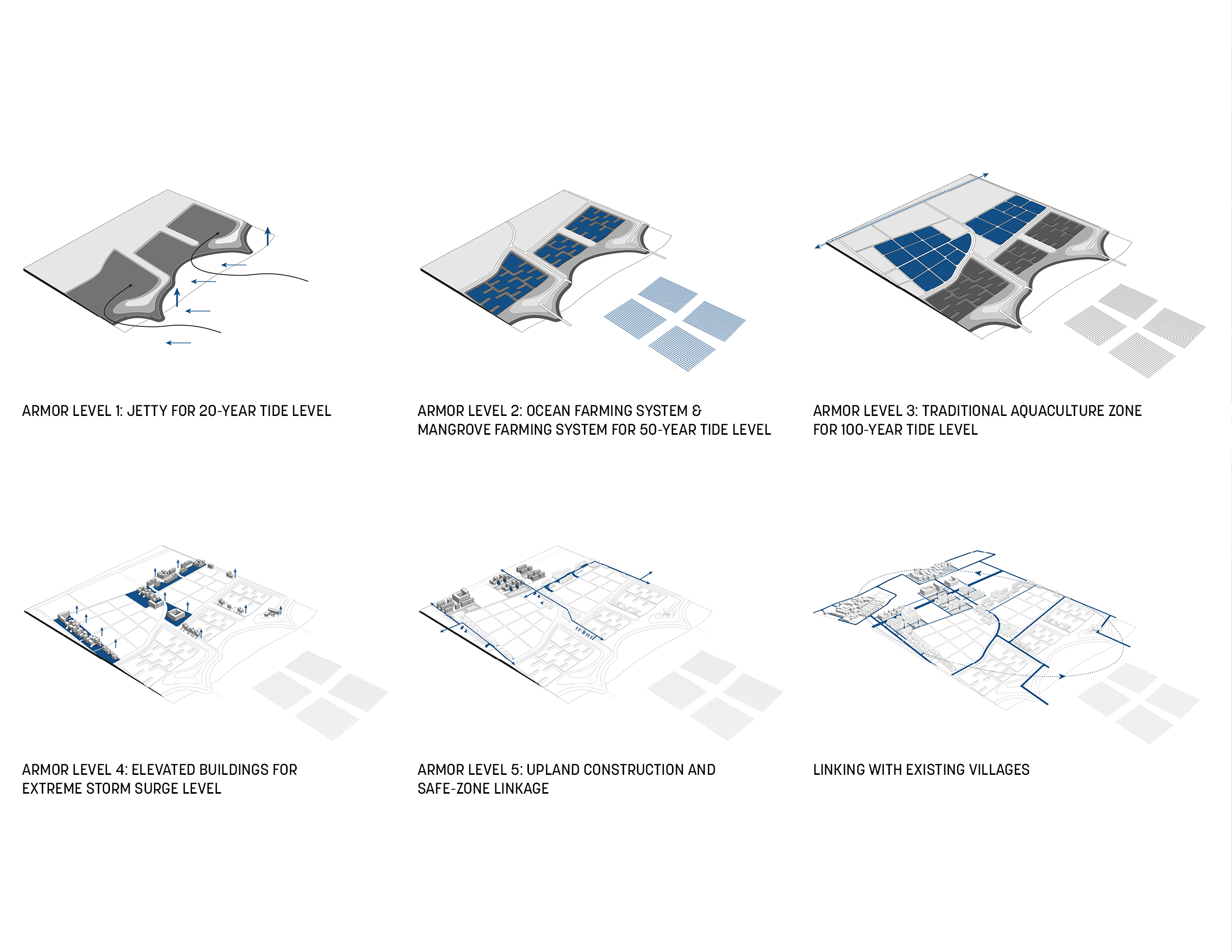
Instead of ripping out of the Aquaculture ponds and building an artificial seawall, the aquaculture itself would become a soft defense system for climate resilience and protection of urban growth.
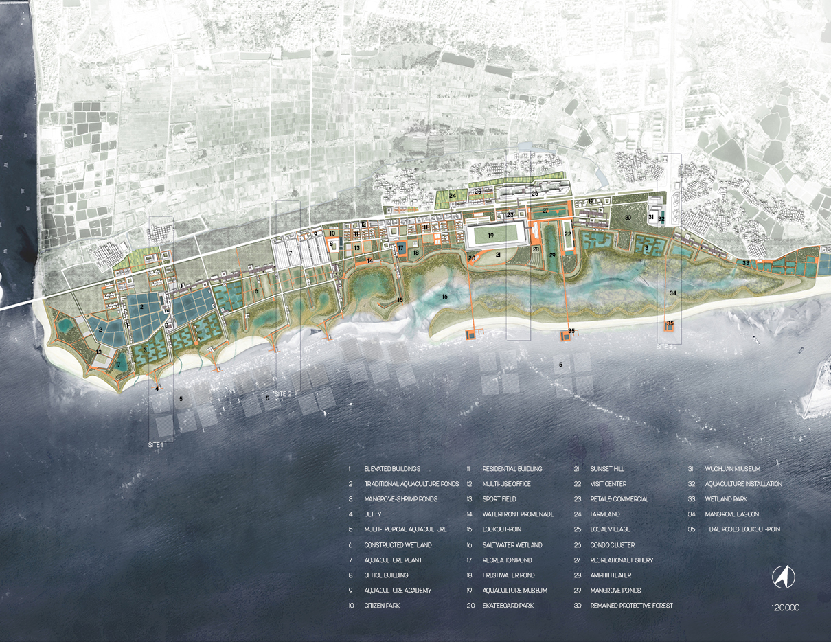
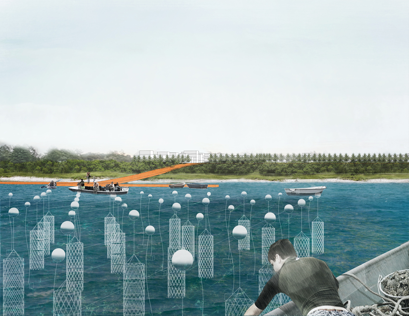
Aquaculture Village Armor: The design stimulates this area by imputing three aquaculture systems, including the IMTA system offshore, the IMS system in tidal flats, and traditional ponds in elevated building areas. Upland Villages and elevated mat-building will provide residential and supporting facilities.
Aquaculture Nursery Armor: Functioning ponds will form several structures for raising. Abandoned ponds will be transformed as constructed wetlands to purify the tailwater from the nursery.
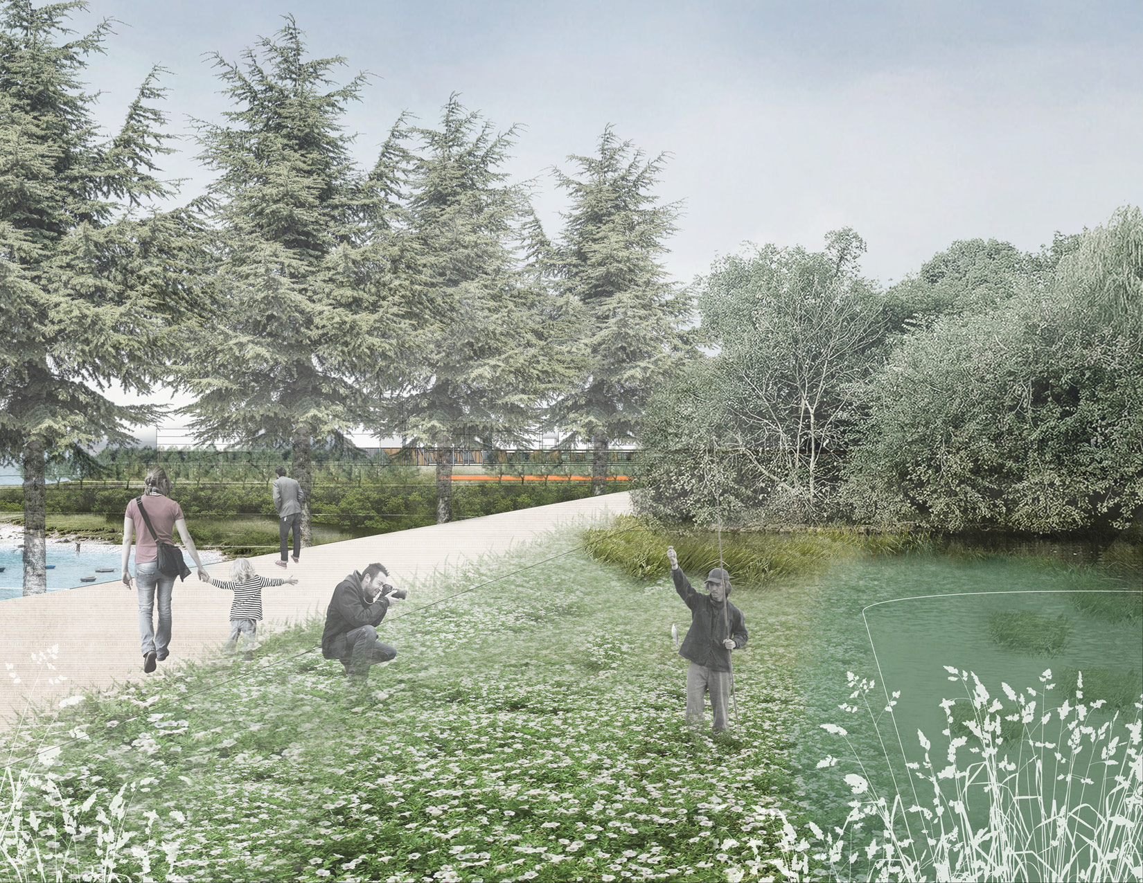
Mix-use Aqua-culture Armor: The new urban development will be connected with the aquaculture museum, which existing factories transformed. The coastal promenade links the public area to the sea farm. The changing tide level only influences the natural dune. A mangrove lagoon protects the reclamation land.
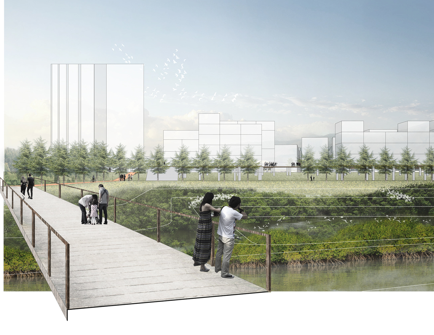
Littoral Central Park: In the central littoral park, one bridge will connect urban expansion and natural dunes. People could wander on the boardwalk and embrace the sea at the lookout deck. Villagers and citizens can see the ocean farm, the mangrove farm, and the constructed wetland to enjoy multiple productive landscapes and the sea’s beauty.
