Thriving and rapid industrialization over the last 50 years has led to many urgent problems and challenges for post-industrial cities fed by China’s most iconic river-Yangtze river. The riverfront of these cities nowadays is serving as the dumping grounds for industrial contamination which is aggravated by seasonal flooding. The legacy of contamination results in the gap between the river and human beings, and has become a barrier for the site’s future development. Using Wuhan Qingshan industrial riverfront as a testing ground, the project seeks to develop a phased strategy that makes the retrofitted levee a spine of protective and accessible public infrastructure, and combines different remediation strategies as cornerstone to weave the physical and spiritual gap between the river and people living nearby, and finally embrace and structure the site’s future development. By introducing accessible flood-protection infrastructures and ecological remediation technologies in stages, the project transforms this post-industrial contaminated riparian space into a urban core with diverse values.
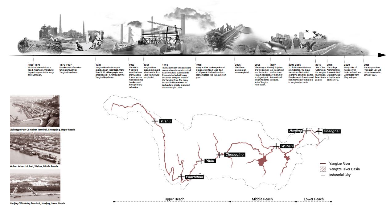
Yangtze river is the longest river in Asia and it is geographically divided into upper, middle and lower reach. It has a long-standing history of industrial function and seasonal flooding. Many industrialized cities emerged along the Yangtze River to take advantage of water resources.
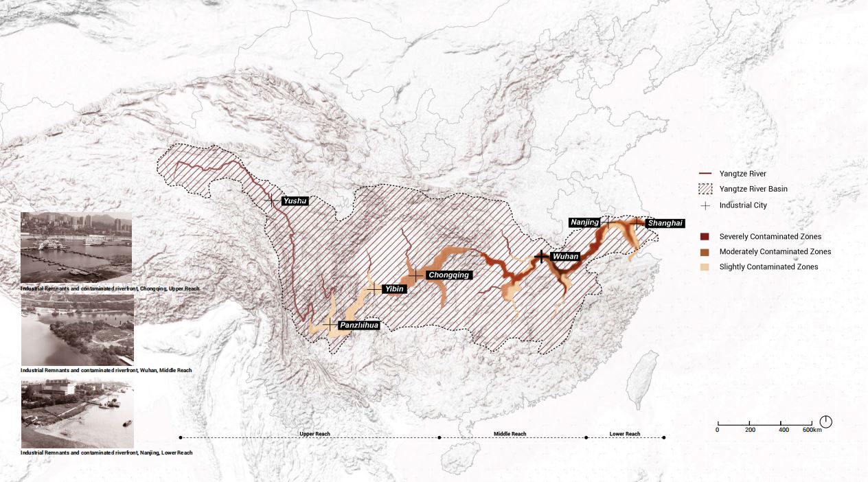
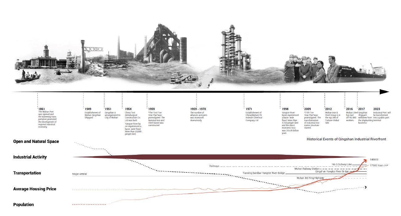
Since the nation’s economic pattern transformed to post-industrial from 2009, many industrial workplaces on the riverfront have been abandoned leaving a contaminated riparian environment.
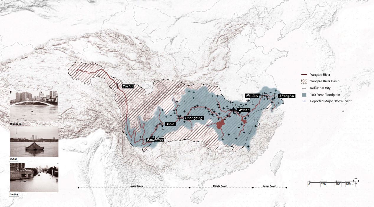
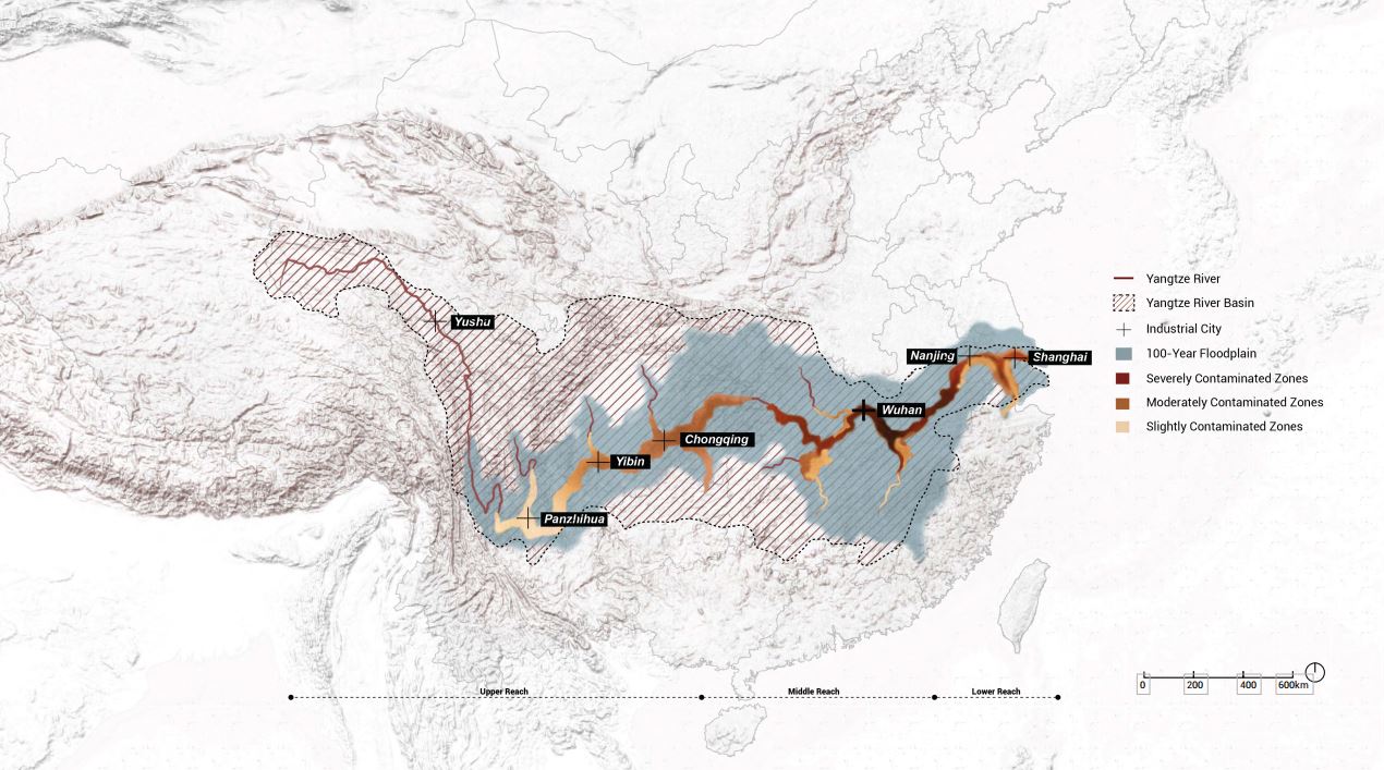
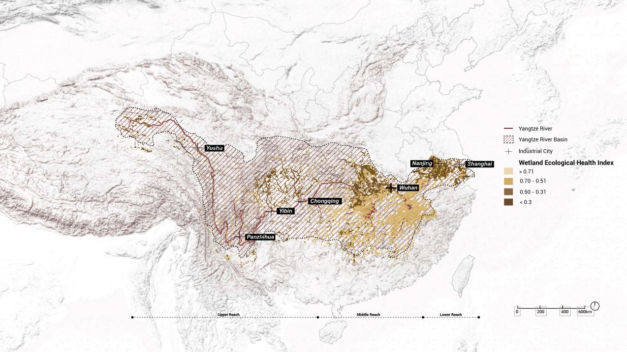
From June to August each year, cities in the Yangtze river basin encounter heavy rainstorms which leads to numerous storm events. Flooding intensifies the industrial contamination of the river and its riparian areas. Contamination and frequent flooding has worsened ecological health of wetlands and has led to widespread and severe ecological degradation.
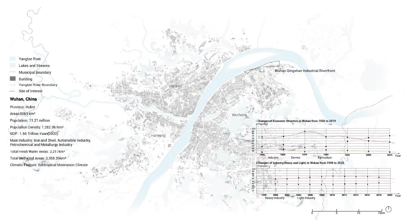
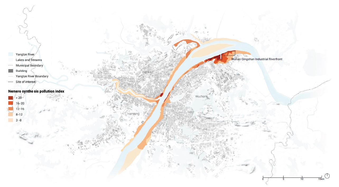
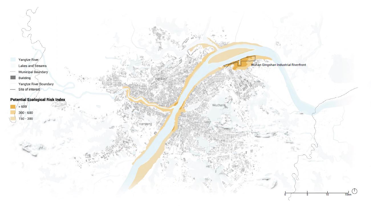
Wuhan is the largest industrial city of central China and has co-evolved with Yangtze river symbiotically for the past 1800 years. The once-thriving heavy industry in Wuhan has decentralized from 1993 to 2020. Many industrial sites built on the riverside have inevitably become post-industrial brownfields. Impacted by residual and ongoing industrial contaminants, the riparian soil of northeast riverfront has the high level of contamination and results in the highest ecological risk. Despite unprecedented advancements in engineering, most urban areas still suffer from flooding.
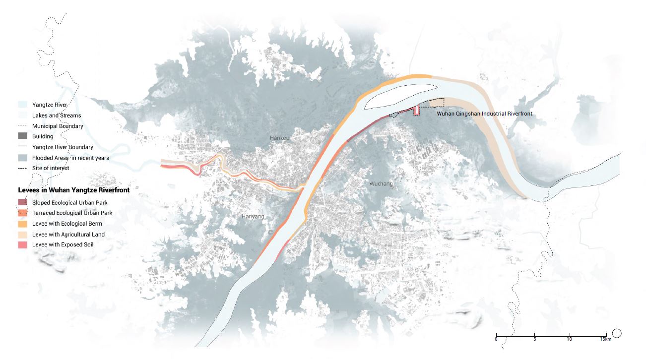
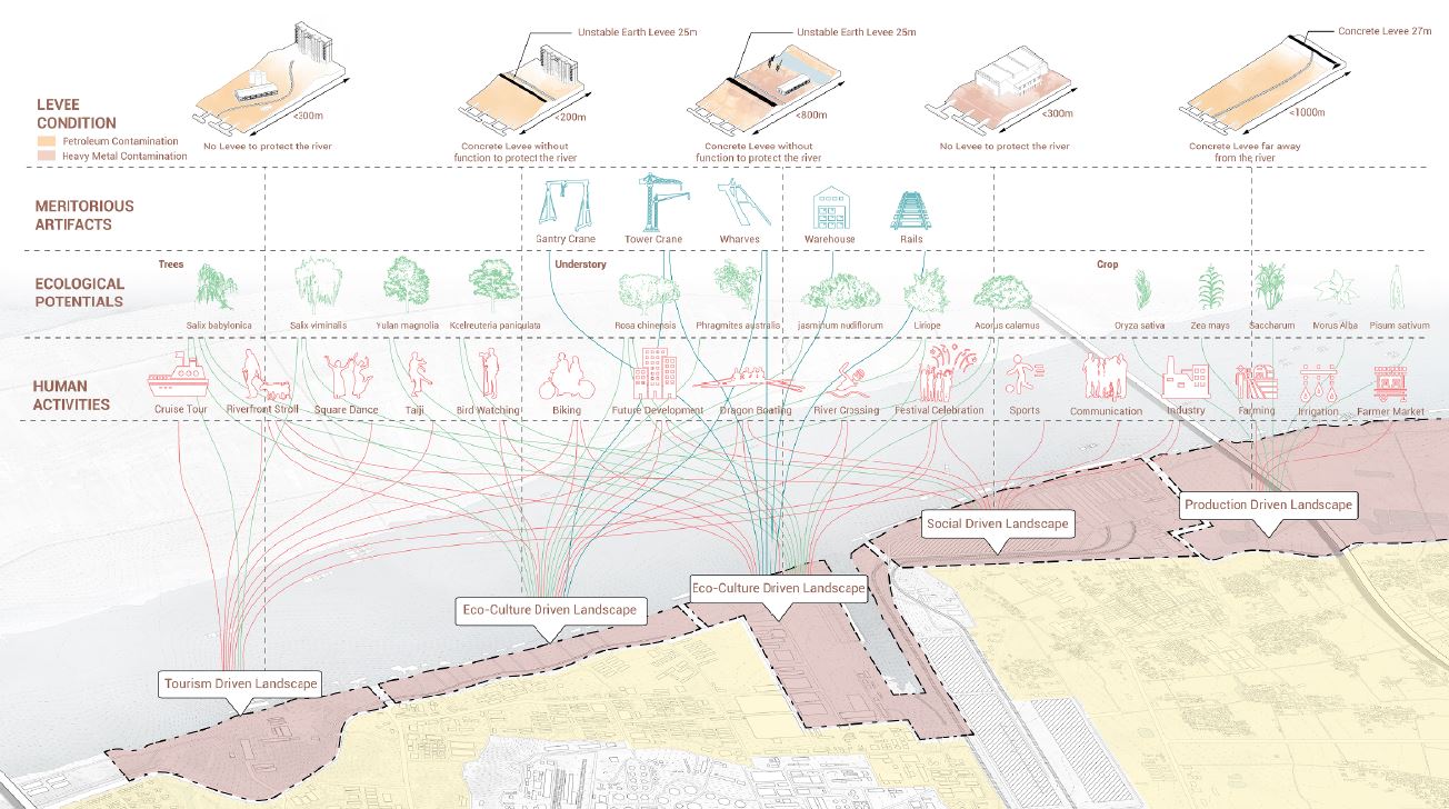
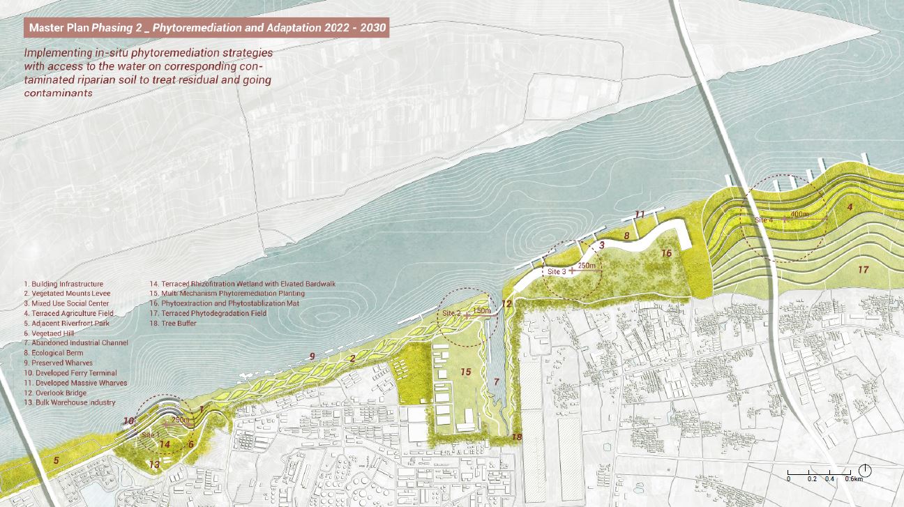
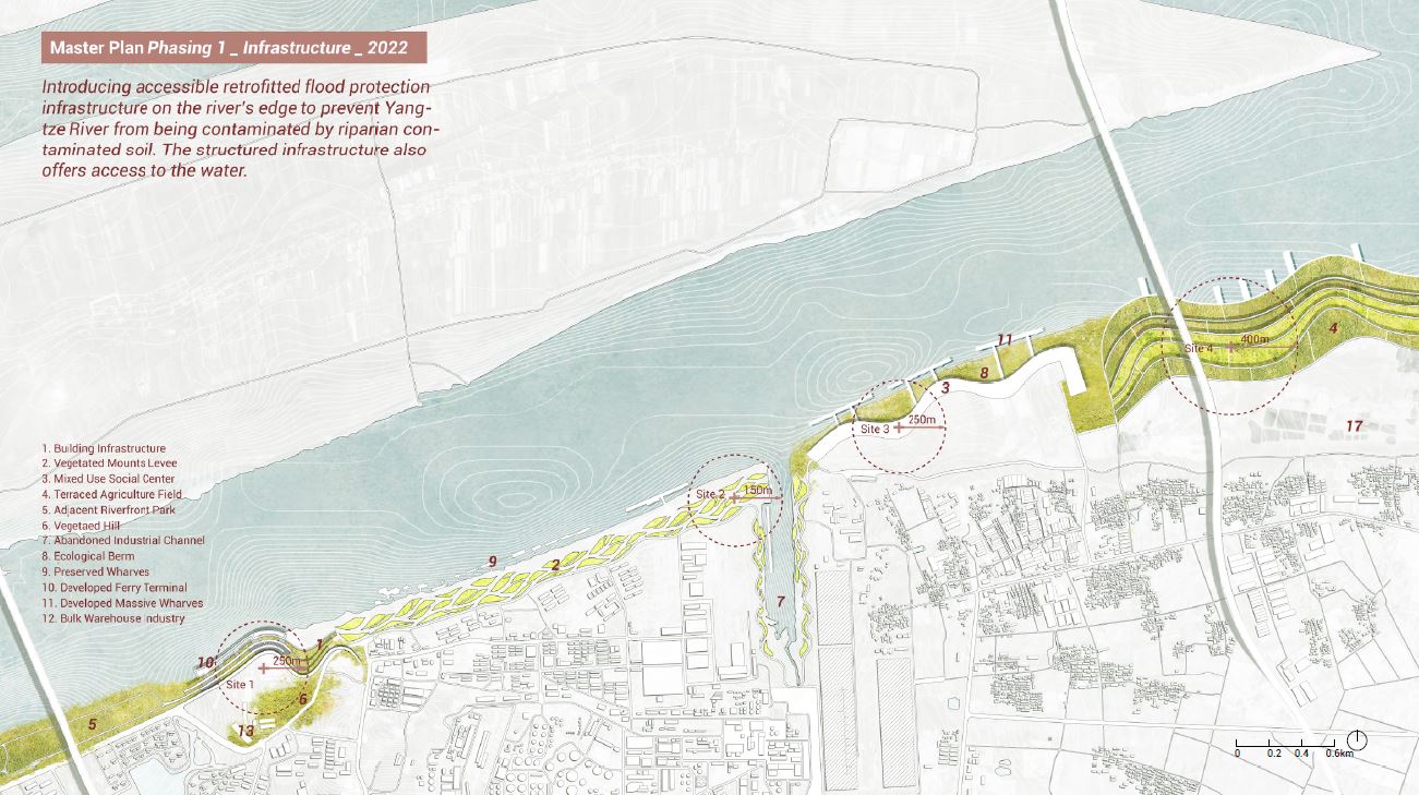
The existing levee constructions in Wuhan can be categorized into five typologies. The maximum water level of Wuhan Yangtze river is about 29m. Normally, the water fluctuates between 14 meters to 19 meters. The levee is transformed into recreational riverfront parks in the sloped and terraced typologies. The next two types have levees with a single ecological or agricultural function. The last levee type is made up of unprotected, exposed soil.
The site of exploration is a 7-kilometer long industrial riverfront along the east riverbank of the Yangtze located in Wuhan Qingshan district.
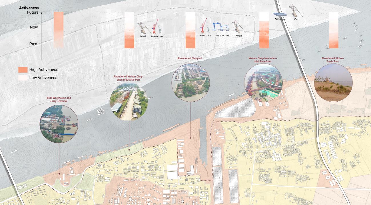
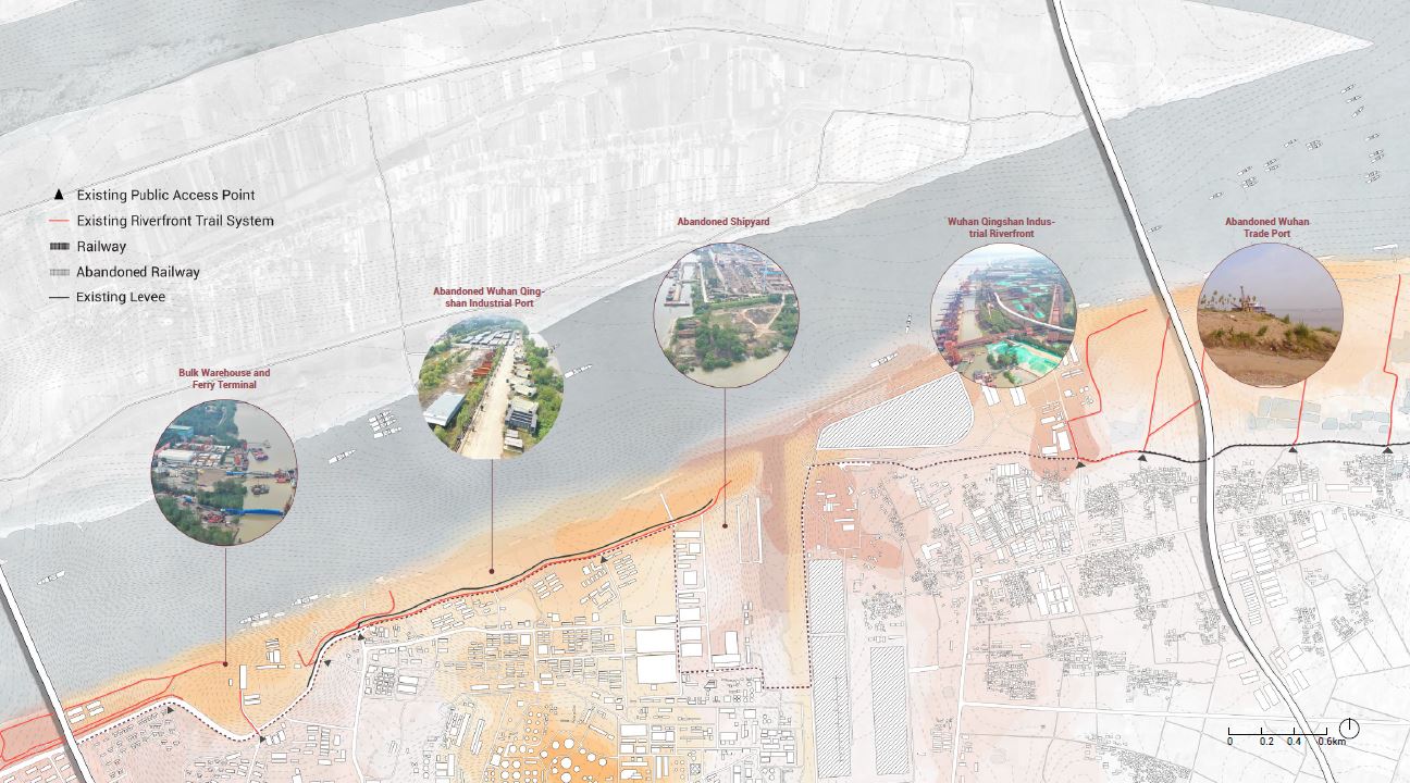
The riverfront is dominated by industrial lands with little accessible open spaces. From west to east, the site is dominated by Bulk and Ferry Terminal, Abandoned Industrial Port, Abandoned Shipyard, Wuhan Industrial Port, and Abandoned Trade Port. The 6 industrial businesses along the riverfront have their own industrial activeness from past to future. Due to the contaminated land occupied by active and abandoned industrial uses, the existing riverfront trail system is disjointed and undeveloped with limited access to riverfront from adjacent neighborhoods. As flooding occurs seasonally, the contamination worsens and threatens adjacent neighborhoods.
The riverfront area has formed a barrier cutting off the connection between people and the river. Therefore, the future development in riparian areas including the land transformation and neighborhood expansion is facing huge challenges caused by this huge disconnectivity.
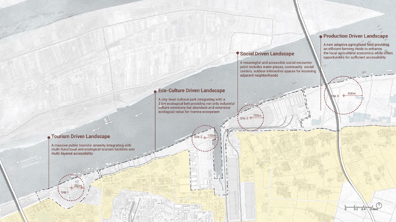
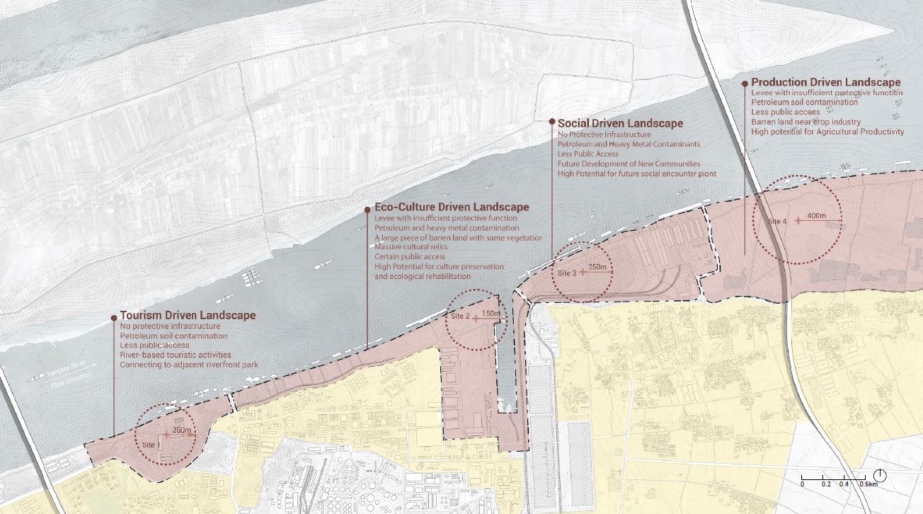
4 types of site restoration-driven landscapes
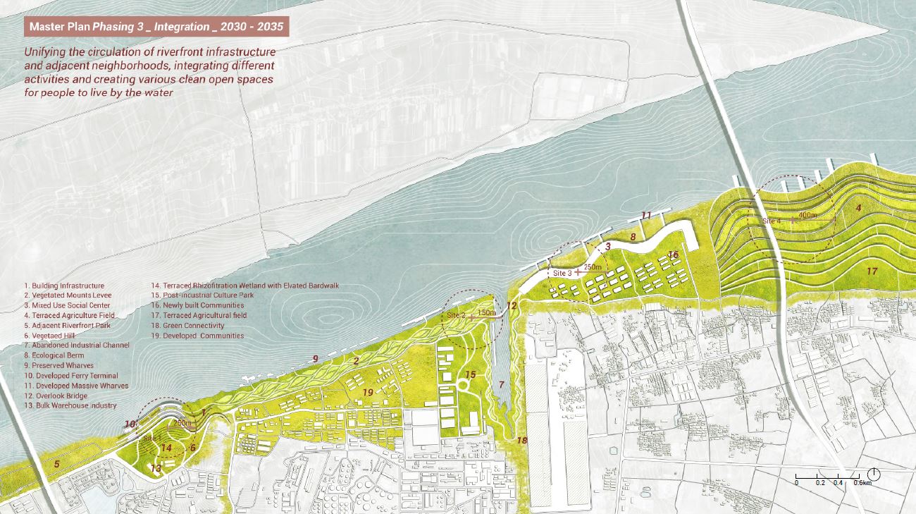
"Three Phasing Plans"
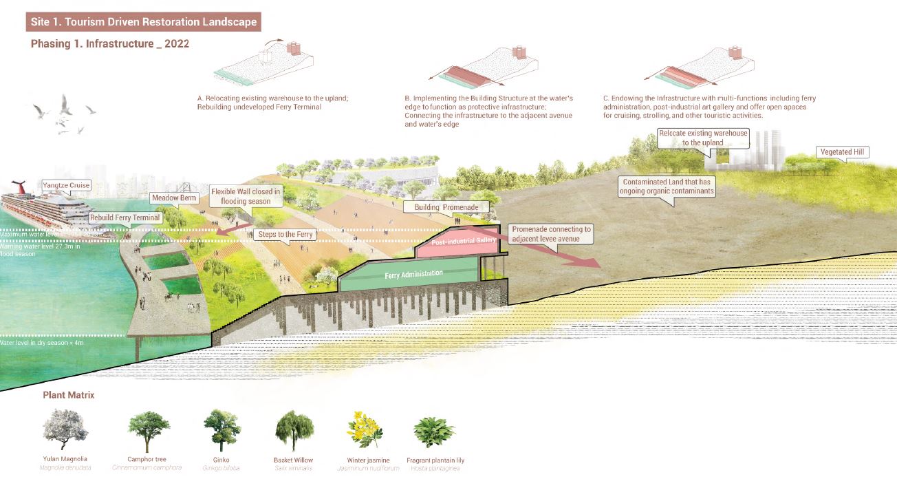
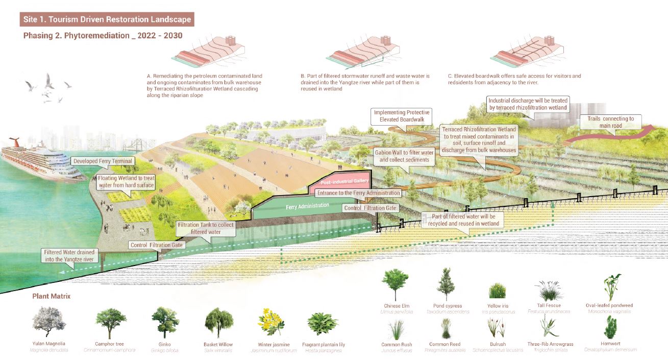
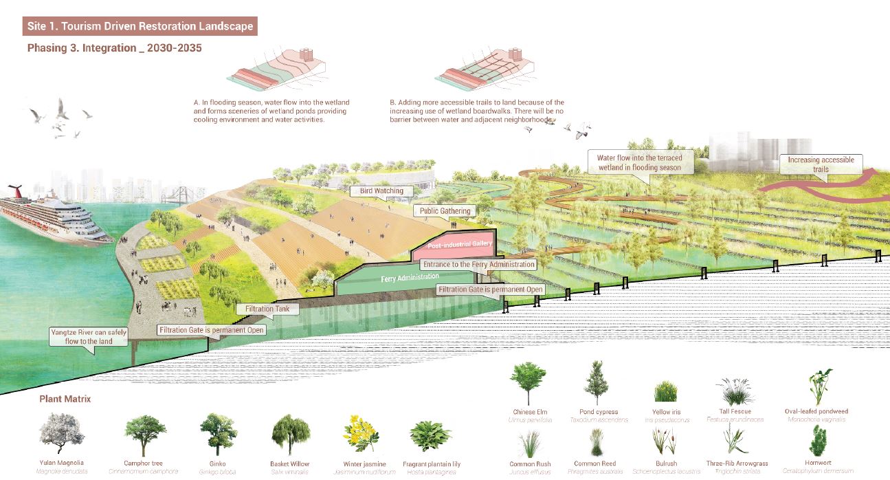
a)Tourism driven Landscape
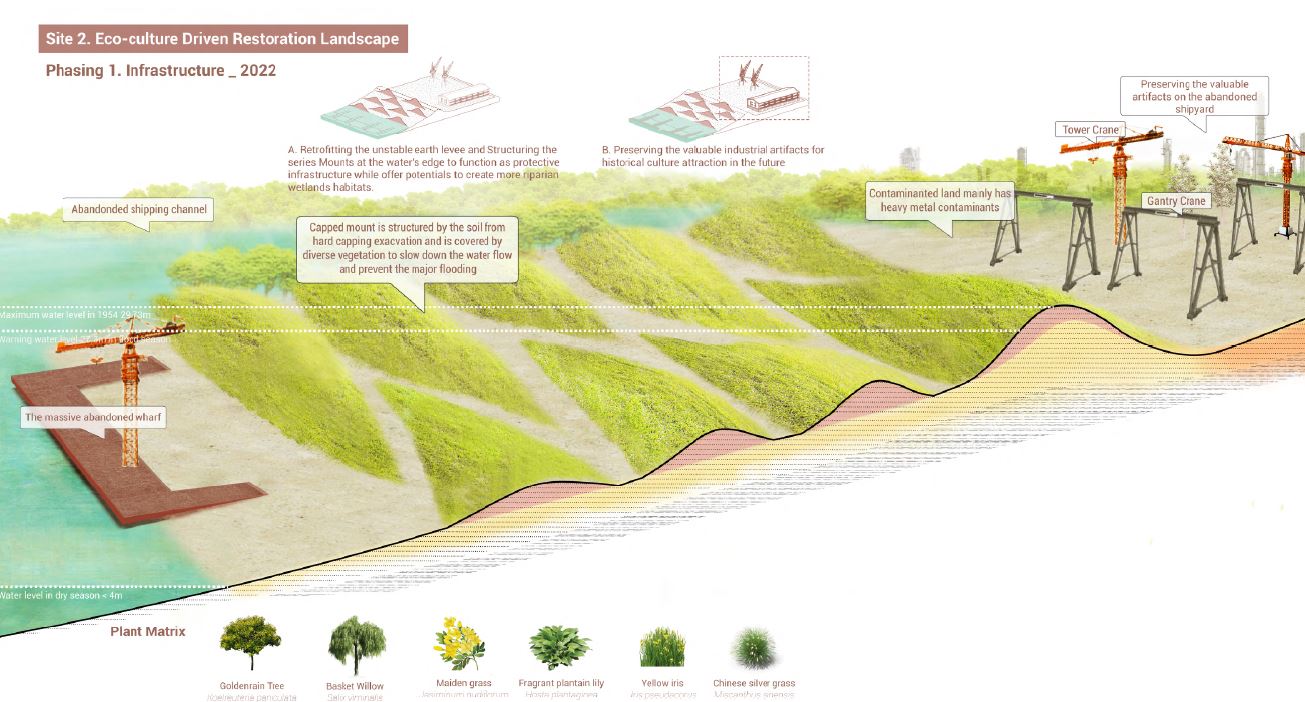
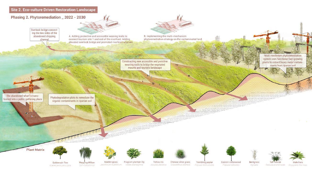
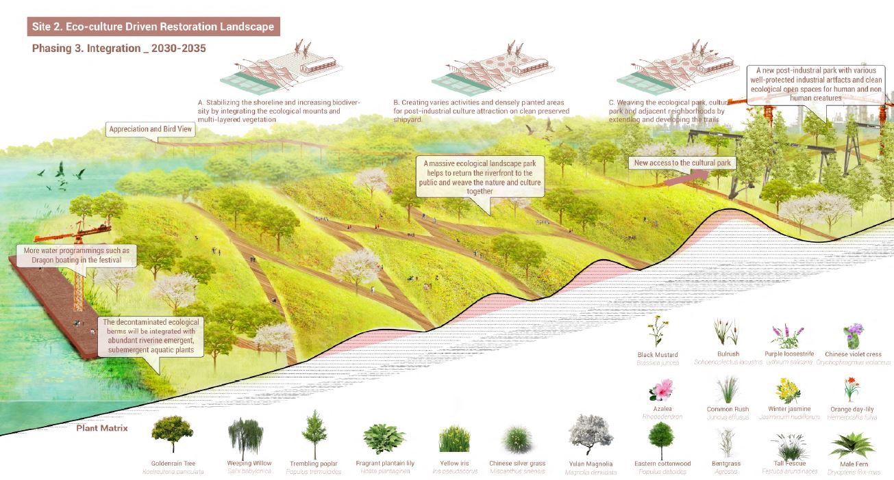
b). Eco-Culture driven Landscape
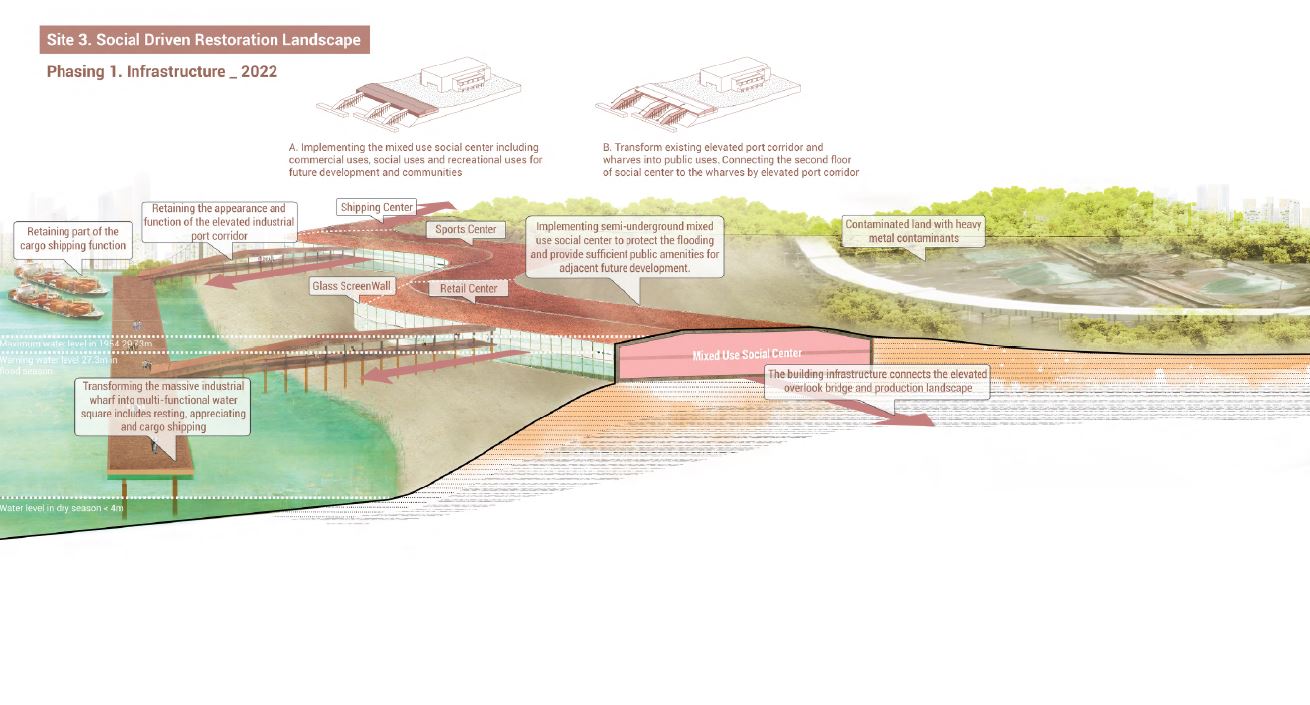
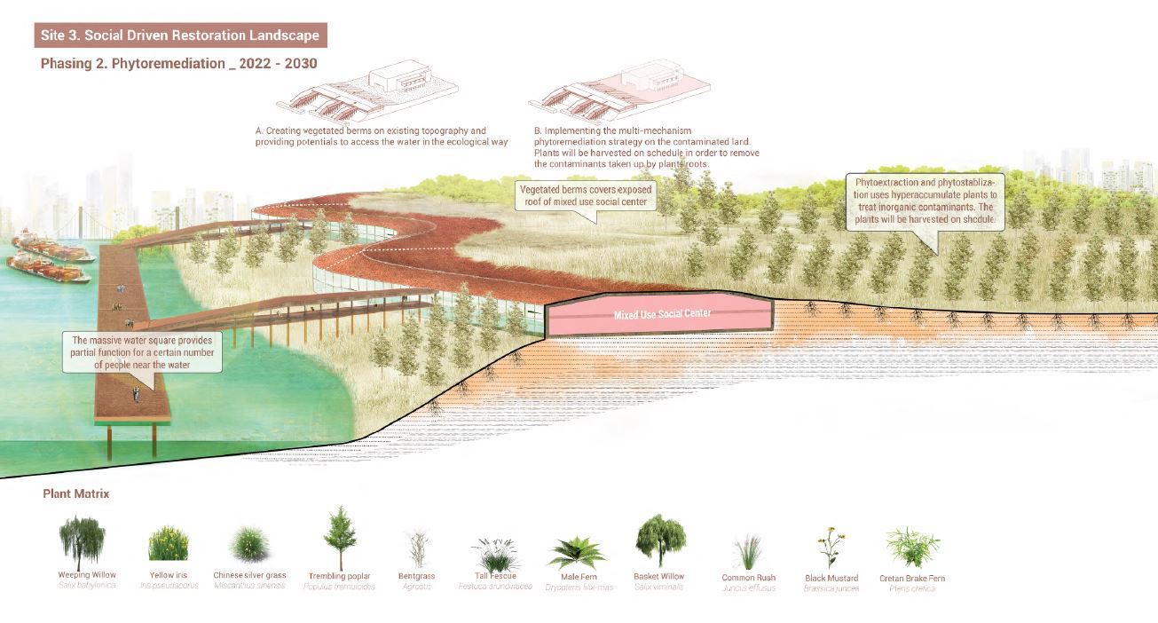
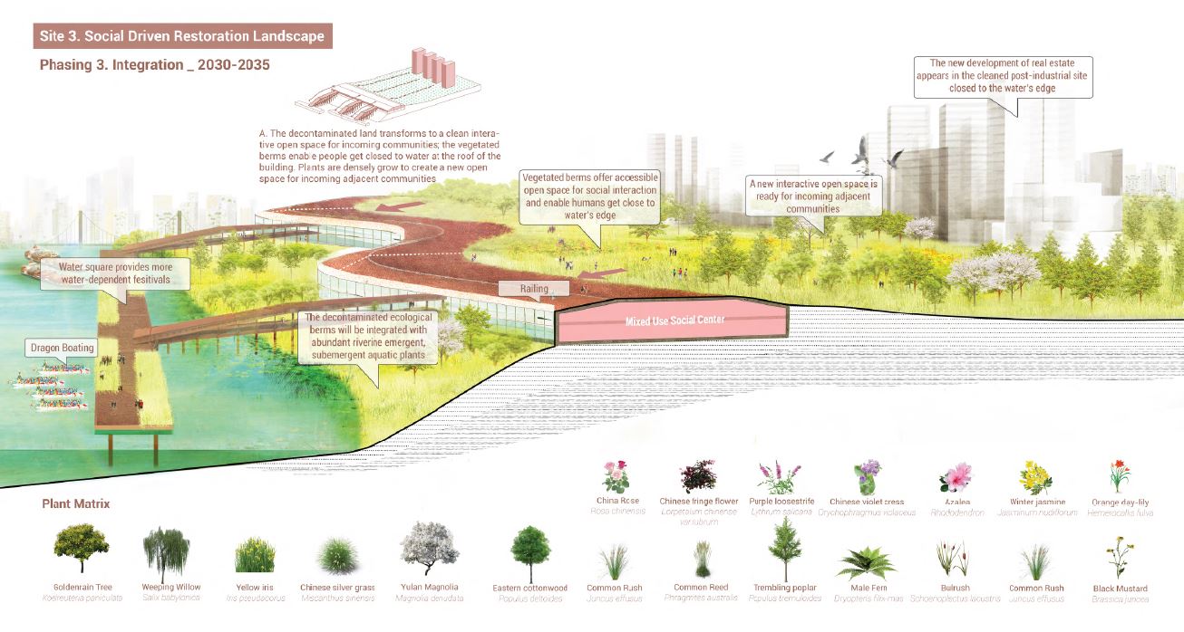
c). Social driven Landscape
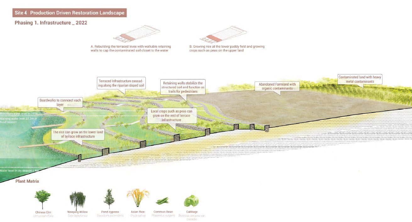
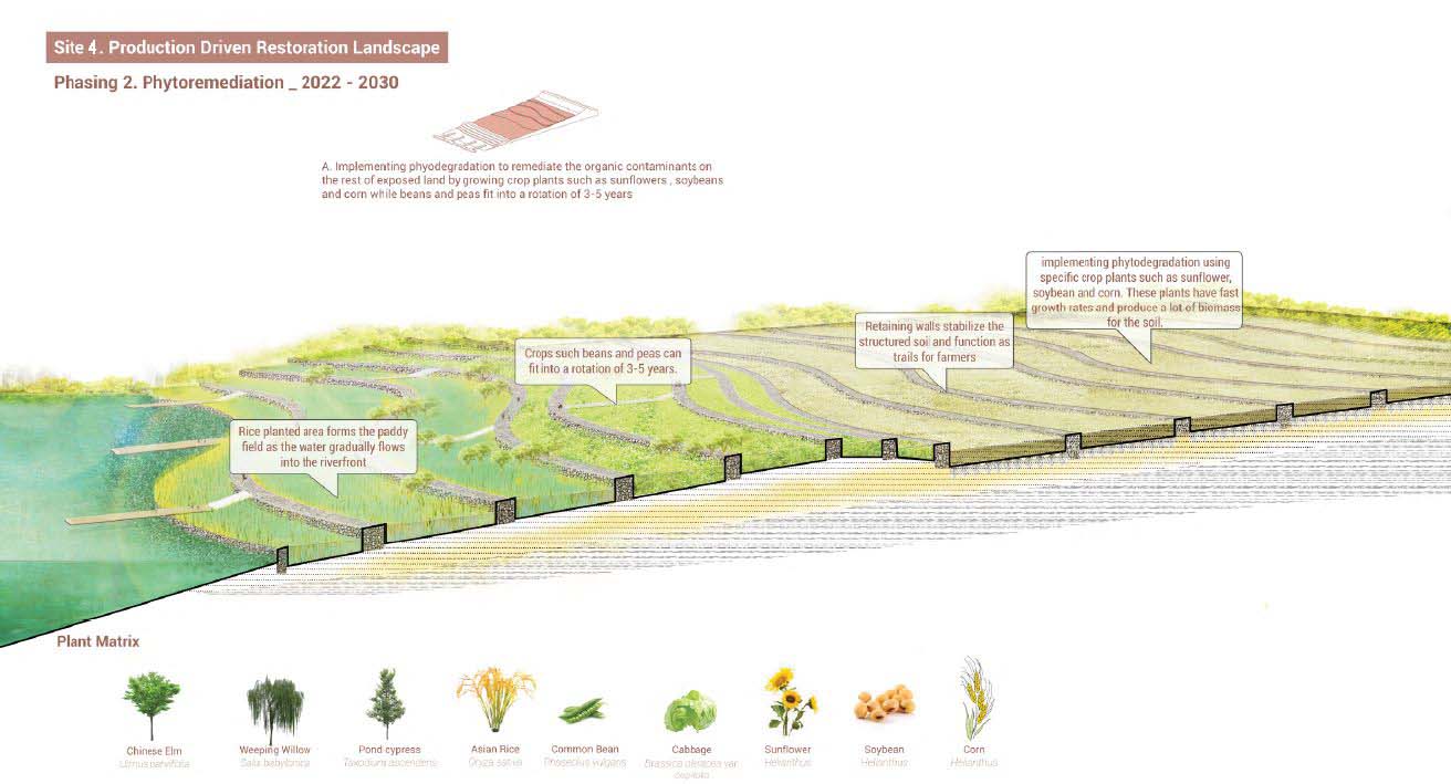
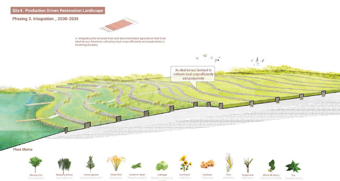
d). Production driven Landscape
From 2022 to 2035, by weaving accessibility, infrastructure, ecology and human activity, the Wuhan Qingshan riverfront is protected, remediated and reconnected as a vibrant and accessible open space for both short and long term needs, adapting in anticipation of future development and people’s desire to be close to the river.