Pre-Settlement Landscape and Vegetation Modeling and Mapping
Danijela Puric-Mladenovic
– Aldo Leopold, American Ecologist
- Have you ever wondered what southern Ontario’s landscape looked like before European settlement and the major land clearing activities that accompanied this process?
- What did the vegetation in southern Ontario look like two centuries ago before farms were established, and our cities, towns, subdivisions, schoolyards, factories and roads were built?
- What was the structure and spatial extent of our forests prior to European settlement?
- How much natural vegetation cover was lost, and from where on the landscape?
- Do our parks, protected areas, conservation lands, ravines, remnant forests, woodlots, wetlands and grasslands resemble the historic vegetation of two centuries ago?
- Have you ever wished you had wall-to-wall maps of the pre-settlement vegetation and landscape to help you make informed resource management decisions?
-
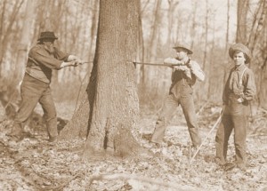
- Archives of Ontario. Series C 7-3. Ontario Legislative Library print collection.
-

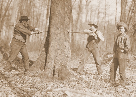
- Archives of Ontario. Series F 1125-1. Ontario Legislative Library print collection.
These questions can be answered as we map southern Ontario’s past, and begin to use this information to understand the present and shape our future.
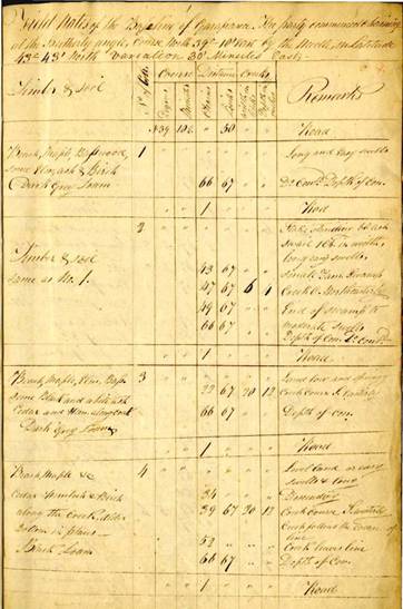
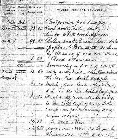
Using statistical modeling and prediction techniques, historical information is converted into maps of pre-settlement vegetation and landscape condition, which can be used to support and inform conservation efforts and natural resource management. The process draws on information about historical vegetation and landscape condition from old land surveyors’ records, historical maps, documents, and botanical records.
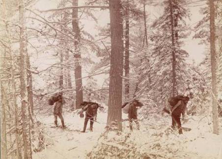
Surveyor Generals Office, OMNR
Areas modeled and mapped in Ontario:
Regional Municipality of York (Puric-Mladenovic, D. 2003)
-
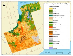
- York
-

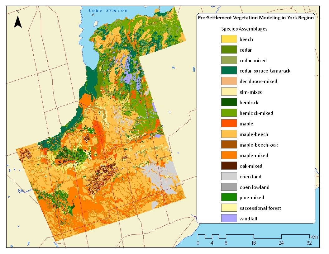
- Algonquin Provincial Park map
-

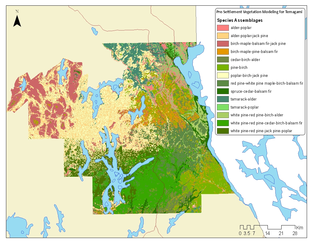
- Temagami Provincial Park (Puric-Mladenovic, D. and Pinto, F., 2005)
- Pre-settlement vegetation mapping the southwestern Golden Horseshoe – Version 1 (2010)
- Pre-settlement vegetation mapping the southwestern Golden Horseshoe – Version 2
- In development , for more information contact Danijela Puric-Mladenovic
Presentations
Partners / Team Members
Team members
Partners
Referencing this Document
When referencing a map, please indicate which map was used and reference as follows:
Puric-Mladenovic, D. 2011. (Product). Pre-settlement Vegetation Mapping for the Greater Toronto Area, including the Regions of Hamilton, Halton, Peel and York and the Credit Valley Watershed. Ontario Ministry of Natural Resources. Southern Science and Information Section. Peterborough Ontario. January 2011.
When referencing the document itself and not a specific data product, simply exclude the bolded parts from the above reference.
Contact
Danijela Puric-Mladenovic
https://academic.daniels.utoronto.ca/forestry/puric-mladenovic-d/
Downloads
Download Pre-settlement Documents
Brochure
FAQ – Pre-settlement vegetation mapping
Regional Municipality of York (Puric-Mladenovic, D. 2003)
Final Report Version 1
Download Pre-settlement Maps
York map
Algonquin Provincial Park
Temagami Provincial Park
Version 1 Maps