By Fernando Calderon Figueroa
Description of the Study
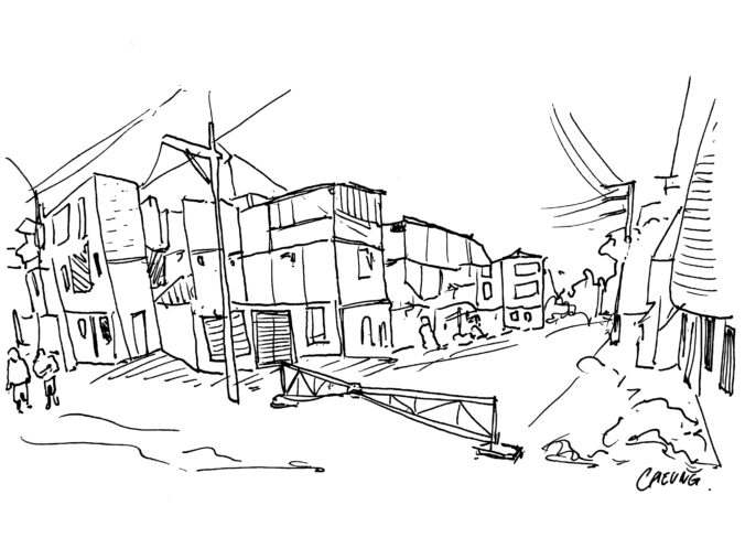
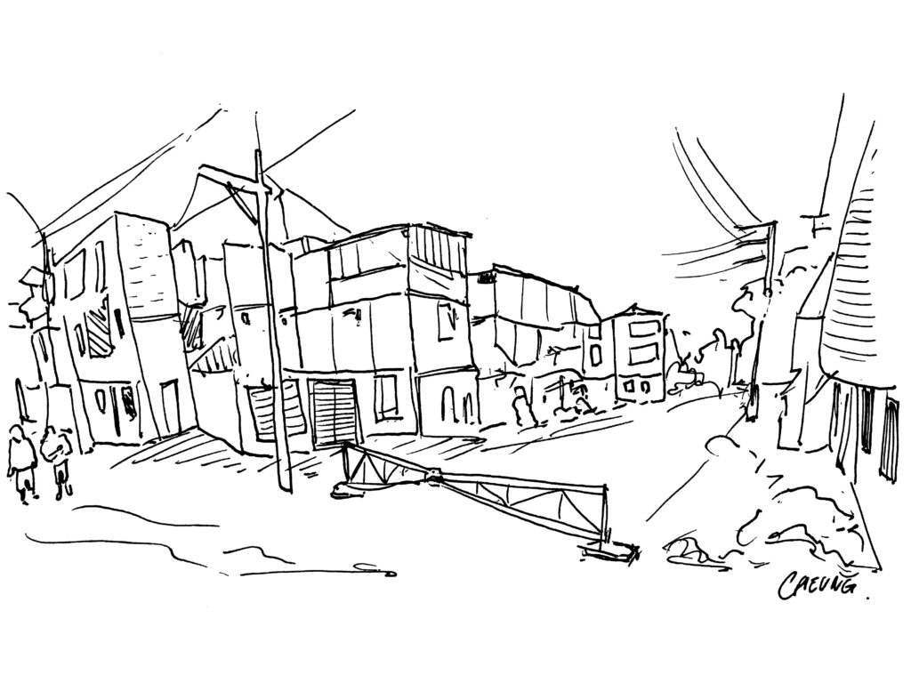
This study addresses the relationship between residential micro-segregation, in the form of built barriers to urban mobility, and social capital. Most of the scholarship on residential segregation posits the neighbourhood as its most relevant scale of analysis, while discussing built barriers as expressions of pre-existing social boundaries and as the result of higher-status groups’ attempts to seclude themselves from lower ones (Caldeira 2000; Garrido 2019; Massey and Denton 1993). A recent thread of studies has shown the importance of the street level for segregation patterns by bringing attention to the built environment (Grannis 1998; Grigoryeva and Ruef 2015; Logan, Graziul, and Frey 2018; Roberto 2018). Following this line of work, I draw on the notion of spatial micro-segregation to describe the patterns of urban fragmentation that result from resident-driven street enclosures within and across neighbourhoods.
I attempt to empirically test two theoretical propositions:
- Residential micro-segregation is a socio-spatial process that occurs in the more recently developed residential areas of highly unequal cities that cuts across socioeconomic and ethnoracial boundaries.
- Empirically, this proposition implies that micro-segregation must be pervasive throughout residential neighbourhoods and particularly concentrated among the most recently developed ones. There should be no correlation between the density of street barriers (e.g., gates, fences) and the socioeconomic or ethnoracial heterogeneity within and across neighbourhoods.
- Residential micro-segregation negatively impacts the development of social capital and sentiments of community. Barriers to mobility express a form of social closure defined by location that interacts with the existing sociodemographic and ethnoracial composition of the neighbourhood.
- Empirically, this proposition suggests that measures of social capital (e.g., interpersonal trust) should have decreased in the past few years in areas of the city with higher concentrations of street barriers.
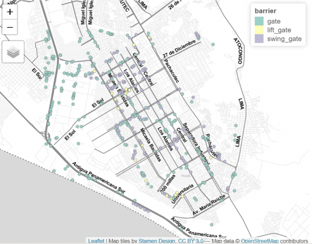
To test these hypotheses, I use the case of Lima, Peru. I draw on the OpenStreetMap project (OSM) to identify the thousands of street-level barriers to mobility built in the city since the late 1990s. OSM is an open access platform, which allows the data to remain public beyond the scope of this study. While a fraction of street barriers has been reported, I am completing the data using georeferenced photographs posted on Mapillary and directly collecting images using an unmanned aerial vehicle (UAV or drone). The sociodemographic and ethnoracial composition comes from the block-level sociodemographic data published by the Peruvian National Institute on Statistics and Informatics (INEI) for the most recent census years (2007 and 2017). To assess social capital changes over time, I use an annual survey (N≈1,200 per year) on community issues conducted since 2010 called Lima Cómo Vamos.
This paper aims to expand our current knowledge about segregation patterns and their implications for social capital in highly unequal cities such as those in Latin America and throughout the Global South. I expect to complete a draft of the article by the end of 2022.
Preview of Spatial Analysis
Here is a preview of the street barrier data collected so far using OSM. The map shows the barriers, by category, in Villa El Salvador, a district in the south of Lima.
References
Caldeira, Teresa P. R. 2000. City of Walls: Crime, Segregation, and Citizenship in São Paulo. University of California Press.
Garrido, Marco. 2019. The Patchwork City: Class, Space, and Politics in Metro Manila. University of Chicago Press.
Grannis, Rick. 1998. “The Importance of Trivial Streets: Residential Streets and Residential Segregation.” American Journal of Sociology 103(6):1530–64.
Grigoryeva, Angelina, and Martin Ruef. 2015. “The Historical Demography of Racial Segregation.” American Sociological Review 80(4):814–42. doi: 10.1177/0003122415589170.
Logan, John R., Chris Graziul, and Nathan Frey. 2018. “Neighborhood Formation in St. Louis, 1930.” Environment and Planning B: Urban Analytics and City Science 45(6):1157–74. doi: 10.1177/2399808318801958.
Massey, Douglas S., and Nancy A. Denton. 1993. American Apartheid: Segregation and the Making of the Underclass. Cambridge: Harvard University Press.
Roberto, Elizabeth. 2018. “The Spatial Proximity and Connectivity Method for Measuring and Analyzing Residential Segregation.” Sociological Methodology 48(1):182–224. doi: 10.1177/0081175018796871.

Leave a Reply
You must be logged in to post a comment.