Category: Research Lines (Page 2 of 2)

Darwin’s Dangerous Idea of a City

Description

This project is an effort to extend and adapt basic evolutionary concepts to the study of cities.  It starts from the proposition that urbanites are a city’s way of making another city.  Cities encode information about how to make new versions of themselves.  This information contains implicit instructions for the types of uses and users that would recreate the city, or more specifically the various features and forms that comprise it.  But this code cannot run itself, it requires facilitating conditions that can process it: urbanites.  In running the urban script, urban dwellers are recruited into making tomorrow’s city resemble today’s.  As this takes place in a shifting, uncertain, competitive, and complex environment, this is far from a static or deterministic process. The genetic code of cities is constantly evolving through mutations, selective pressures of various forms, differential replication, and related processes.

Taking this statement seriously orients the Urban Genome Project.  A first and major theoretical challenge is to transform this intuition into a tractable model that can inform research.  The goal is to fashion a structured yet flexible vocabulary for formulating and exploring hypotheses about urban genetics.  This model is not created anew from whole cloth.  Rather, it joins elements and ideas from diverse fields of urban and related research into a synthetic framework.  Nor does it seek to determine a priori all relevant variables and how they should be stratified. Yet it does aim to provide a vocabulary for evaluating and comparing potential variables, and guiding questions about how these variables might fit together. 

We pursue this theoretical project along a number of related fronts.  A first step is to articulate a formal definition of the urban genome and the interconnected elements that sustain and change it.   These all cohere in what we term the “Signature.”  

Sig(c, t, F, L, S, E, w)

The Signature encodes, for some spatial area c, at time point or interval t, the physical form, plus information about its intended or implied uses or activities, and intended or implied users or groups (F).  Information about F is transmitted via some signal (S), and reproduced by agents through L which specifies the actual activities performed by actual groups of people, plus the resources available to the groups to perform activities. All of this takes place within a broader macro-environment (E). Finally, w represents a “world” in which the signature exists. In most cases, we will omit this parameter, but when we need to compare alternative signatures for the same space c and time t, w will be used to distinguish them (i.e., alternative worlds).

A second step builds out this model to show how it can be used to articulate processes of recoding.  Recoding occurs when the urban genome (F in the Signature) is changed.  We elaborate several ways that this can happen, for instance through changes in the Environment (Environmentally Induced Recoding), in the activity patterns and identities of agents (L induced recoding), or in the nature and reach of Signals that convey information about the genome (Signal Induced Recoding).

A third step moves from recoding to replication, and introduces the concept of the formeme.  Formemes are urban versions of memes — small bits of urban form that replicate, such as the cul-de-sac, the bohemian neighbourhood, streetscape design, or public art.  Adapting concepts from population genetics, we develop models for the study of population formetics, which examine changes in the formetic diversity of urban populations.  Key processes that shift formetic diversity include migration, mutation, and selection.  As formemes spread and adapt, they form lineages and are subject to differential survival rates, generating the basis for evolving urban species.

Last we develop concepts for studying more complex evolutionary processes, in which multiple genomes, signatures, and formemes combine into larger complexes that in turn create distinct ecologies.  Examples of such processes include seeding, scaling, and niche construction.  
An evolutionary ecology of urban form

Teaser

Description

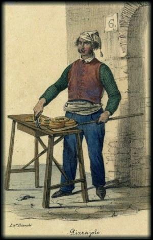
One crucial way that urban forms emerge, transform, and spread is through defining them as spaces geared for specific activities.  This imposes costs on using them for different activities, making them more likely to persist, but also perhaps decreasing flexibility.  This project develops a case study of this dimension of urban formetics, studying the spread of certified Neapolitan Pizza establishments across and within cities. By developing a case, we hope to contribute to a more refined understanding of key concepts in the UGP and illustrate how they might be studied.  Key questions include:

  1. What kind of urban environment did this pizza style emerge out of?
  2. What kind of urban environments, did this pizza style spread to?
  3. Are there regularities in the spatial diffusion of Neopolitan pizza over time?

To develop and pursue these propositions, we adapt key ideas from evolutionary ecology, such as density dependence and niche width. 

For example, we hypothesize that uncertified pizza is likely to proliferate where density of pizza and similar establishments is low; by contrast, certified pizza is likely to emerge where the pizza carrying capacity is near its threshold, and success depends upon quality indicators.  We also hypothesize that other mechanisms are at work.   For instance, content bias: Neopolitan pizza should initially appear in spatially and socially proximate areas, i.e. it should appear both nearby its “home” and in areas with high proportions of Italian immigrants.  Frequency bias: as it spreads, others copy it, thereby increasing its niche width to more socially diverse environments.  

Public Art Policies as vehicles by which urban forms spread

Teaser

Description

Formemes are reproducible bits of urban form.  Though they circulate through various mechanisms, urban policies are key conduits through which forms are transmitted.  This study investigates how urban forms spread through an examination of public art policies.  Using a corpus of hundreds of policy documents from over 25 cities covering over forty years we pursue three major research questions:

1) What are the main ways that these documents speak about Public Art?

2) When and where these ways are taken up? 

3) What are the determinants that shape the taking-up of any of these possibilities? 

Patchwork metropolis

Teaser

San Francisco's Urban Form

Description

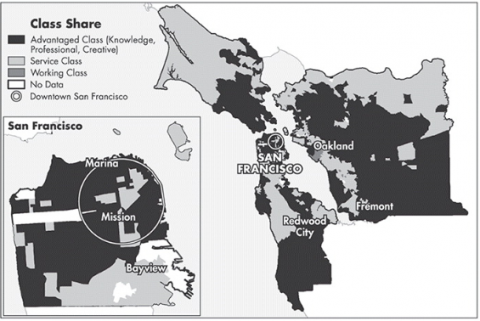
Urban Studies has periodically been concerned with establishing dominant models for urban form, among them: “The Concentric Ring”, the “Multiple-Nuclei” the “Hole in the Donut” and more recently the “Great Inversion”.   This project hopes to contribute to this tradition by bringing modern mapping and image processing techniques to the understanding of models of urban form. Does the pattern of streets and residents conform to a or a few discrete models? As cities develop does their form converge on some higher order model? 

Links
The patchwork metropolis: The morphology of the divided postindustrial city

The scope of urban scale

Description

Scaling is a basic process that characterizes many forms of life.  It refers to the fact that key features of entities strongly depend upon their size, and that in many respects larger versions of life-forms are scaled up versions of smaller ones.  For example, while elephants and mice have very different heart rates, their hearts beat about the same number of times over the course of a lifetime.  Likewise, many features of cities — such as the number of gas stations or patents — can be reliably predicted simply based upon their population size.  According to this view,  developed by Geoffrey West, Luis Bettencourt, and colleagues, larger urban forms are scaled up versions of smaller ones.

This parallel between basic features of organic and urban life has spawned a robust yet recent research tradition devoted to the study of urban scaling laws.  Central to this research is the observation that entities may scale superlinearly, sublinearly, and linearly, often referred to as “scaling regimes.” This means that a feature may increase faster (super), slower (sub), or at the same pace of the city size.  Sub-linear scaling represents economies of scale, whereas super-linear scaling is associated with increasing returns to interaction (which may result in higher crime rates or greater innovation).  Some observers see scaling in terms of innovation cycles and the evolutionary theory of urban systems – superlinear regimes characterize innovative sectors, whereas sublinear regimes result from the diffusion of innovations throughout the system. 

Our research problematizes a key assumption of this tradition: that scaling regimes depend upon the definition of the city in question, in particular its geographic borders.  Rather than search for the ‘true’ definition of the city’s boundaries, however, we instead suggest viewing cities as operating simultaneously at multiple scopes and scales.  For example, New York’s financial services industry on Wall Street may have a much wider scope than a gas station on the same street.

Building on this insight, we develop a series of techniques to identify and understand the scope at which various local features scale.  In particular, we deploy a search algorithm that finds for any feature (e.g. business types) the geographic area in which it reliably scales with population.  These scopes vary widely.  Second, we use these measures of scope to propose a new way to differentiate cities, in terms of size and variety of the scope of experience they offer.  In some cities we exist in large and diverse scopes, in others most scopes are small and similar.  Third, we examine how scope varies across the urban system, and fourth how it has evolved over time.  Overall, this research develops a more complex notion of cities as complex systems of features operating and interacting at many different scales. 

Evolutionary models of urban form

Description

Extending the basic simulation framework developed in “Dynamic Models of Urban Segregation,” this research seeks to develop an explicitly evolutionary model based on concepts derived from “Darwin’s Dangerous Idea of a City.”  Adapting the style of simulation research from Maynard-Smith to Axelrod, we assign “strategies” to venues.  Strategies are various ways in which a venue may seek to optimize its ability to attract and sustain participants.  As some strategies succeed and fail, cities evolve in more or less stable ways.  

Piccard: Visualizing demographic evolution using geographically inconsistent census data

Teaser

Description

Census measurements provide reliable demographic data going back centuries. However, their analysis is often hampered by the lack of geographical consistency across time. We propose a visual analytics system that enables the exploration of geographically inconsistent data. Our method also includes incremental developments in the representation, clustering, and visual exploration of census data, allowing an easier understanding of the demographic groups present in a city and their evolution over time. We present the feedback of experts in urban sciences and sociology, along with illustrative scenarios in the USA and Canada.

Links
Prototype interface
Paper (PDF)

Newer posts »